






Best Long-Distance Walking Routes in Europe
A long-distance walk is a named, waymarked route that takes days or weeks to complete, linking villages, huts and towns into a single journey. Europe has hundreds of them. The twelve long-distance walking routes and multi-day hikes below are the ones we'd send a friend to first.
We chose routes that can be walked over several days without camping, with established accommodation along the way - mountain refuges, guesthouses or village inns. Every trail is officially named and waymarked, takes at least four days in full, can be tackled in sections, and gives a sense of journey rather than a series of day walks.
The range is deliberate. It runs from Alpine circuits and a Pyrenean traverse to pilgrim roads, island coast paths and Dutch lowland. For each trail you'll find the full route in numbers, then the section we'd choose if time is short.
| Trail | Country | Full length | Days (full trail) | Grade | Best months |
| Tour du Mont Blanc | France, Italy, Switzerland | c.170 km (105 mi) | 10–12 | Challenging | Late June–mid Sept |
| La Transpirenaica (GR-11) | Spain | c.840 km (520 mi) | 40–45 | Demanding | July–mid Sept |
| Anillo Vindio | Spain | c.55–75 km (34–47 mi) | 4–5 | Demanding | June–Sept |
| Camino del Norte | Spain | c.825 km (513 mi) | 32–36 | Challenging | May–June, Sept–Oct |
| Via Francigena | England, France, Switzerland, Italy | c.2,000–2,200 km (1,240–1,370 mi) to Rome | Walked in sections | Easy–moderate | April–June, Sept–Oct |
| Fishermen's Trail | Portugal | 226.5 km (141 mi) | 12–14 | Moderate–challenging | Sept–Oct |
| Camí de Cavalls | Spain (Menorca) | c.185 km (115 mi) | 9–12 | Moderate | April–June, Sept–Oct |
| Menalon Trail | Greece | 75 km (47 mi) | 5–7 | Moderate–challenging | April–June, Sept–Oct |
| Pieterpad | Netherlands | c.500 km (310 mi) | 26 stages | Easy | April–Oct |
| Coast to Coast | England | c.300 km (182–190 mi) | 13–16 | Challenging | May–Sept |
| South West Coast Path | England | 1,014 km (630 mi) | 7–8 weeks | Challenging | April–June, Sept |
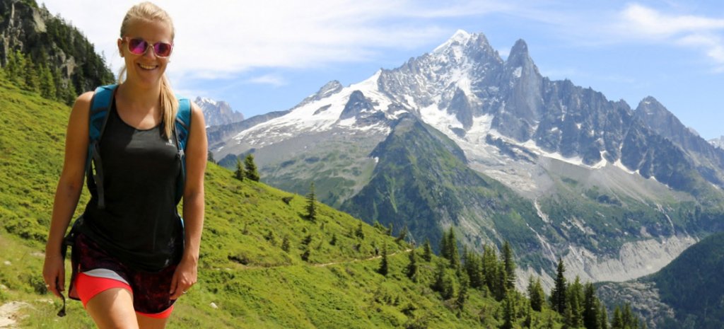
Tour du Mont Blanc - A Circuit of the Highest Alps
- Starts / Finishes: Les Houches or Chamonix (circular)
- Distance: c.170 km (105 mi), with roughly 10,000 m of ascent
- Days: 10–12
- Grade: Challenging
- Best months: Late June to mid-September
- Sleep in: Mountain refuges (both private and shared dorms), gîtes and small hotels
- Waymarking: TMB signposts and red-and-white GR marks
The Tour du Mont Blanc is a hut-to-hut circuit of the Mont Blanc massif, home to the highest mountain in the Alps. It passes through France, Italy and Switzerland in a single loop.
The route crosses a chain of high passes rather than any summit. Col de la Seigne (2,516 m) carries you into Italy; the Grand Col Ferret (2,537 m) takes you on into Switzerland. Each border brings a change of language, architecture and food - polenta and fontina on the Italian side, Valais cheeses in Switzerland.
The TMB is the busiest trek on this list. Waymarks, water points and refuges are rarely more than a few hours apart, but beds fill early, so planning matters more here than anywhere else.
Best stretch: a nine-day loop from Chamonix. A shortened nine-day itinerary from Chamonix covers all the major passes in around 140–150 km. It uses the Bellevue cable car and a couple of short bus hops to skip road sections.
Expect up to 9,000 m of ascent. The highest point is the Fenêtre d'Arpette (2,665 m), a variant between Champex-Lac and Trient with a lower woodland route for bad weather. The hardest day is the last: Argentière to Chamonix via Lac Blanc, with up to 1,620 m of climbing and a section of metal ladders.
Need to know: Refuges fill months in advance for July and August, and some close in June and September - check each one's season before you build an itinerary. Cable cars off the final balcony path stop running in the late afternoon.
Insider tip: Refuge bookings open in mid-October for the following summer. Book the most in-demand stages first, then plan the rest of the route around them.
Keep your eyes peeled for: Alpine ibex around Lac Blanc, in the Aiguilles Rouges Nature Reserve (Tourisme-haute-savoie.com). The reserve has protected this balcony since 1974, which is also why swimming in the lake is banned.
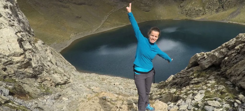
La Transpirenaica (GR-11) - The Spanish Pyrenees, Sea to Sea
- Starts / Finishes: Cabo Higuer, Hondarribia (Atlantic) / Cap de Creus (Mediterranean)
- Distance: c.840 km (520 mi)
- Days: 40–45
- Grade: Demanding
- Best months: July to mid-September
- Sleep in: Mountain huts, village hostels and hotels
- Waymarking: Red-and-white GR marks
La Senda Pirenaica - the GR-11 - crosses the Spanish Pyrenees from the Bay of Biscay to the Mediterranean in around 45 sections. Few people walk it end to end in one go. Most take it a week at a time.
The GR11 is a longer, more remote alternative to the Alpine hut-to-hut circuits. Its central section runs through the Ordesa and Monte Perdido National Park, part of the cross-border Pyrénées–Mont Perdu UNESCO World Heritage Site (Unesco.org).
High passes regularly top 2,500 m. Some huts can only be reached on foot, and a few sections cross boulder fields where careful footing matters more than pace.
Best stretch: Torla-Ordesa to the Aneto massif. Six walking days from Torla-Ordesa to the Refugio de Llauset cover around 86–111 km, depending on the variants you take, with up to 6,900 m of ascent.
The first day climbs the Ordesa canyon to the Cola de Caballo waterfall, then up to the Góriz hut beneath Monte Perdido. From there the route crosses the Añisclo pass (2,450 m), follows the Balcón de Pineta and climbs the Puerto de Chistau (2,592 m) into Posets-Maladeta Natural Park. It ends below Aneto (3,404 m), the highest peak in the Pyrenees.
The biggest day runs from Parzán to the Refugio de Biadós over the Puerto de los Caballos - up to 22 km with 1,580 m of ascent on the longer variant.
Need to know: Góriz, Biadós and Llauset can't be reached by road, so you'll carry your overnight kit on those days. The final climb to Llauset crosses large boulder fields and is the most technical walking of the week.
Insider tip: Private cars are banned from the Ordesa valley in peak season. A shuttle bus runs from Torla to the Pradera de Ordesa roughly every 20 minutes - check current dates and fares before you travel.
Keep your eyes peeled for: The bearded vulture, or lammergeier (Wikipedia.org), which feeds almost entirely on bone. The Aragonese Pyrenees hold Europe's largest population, and Ordesa is a good place to see one riding the thermals.
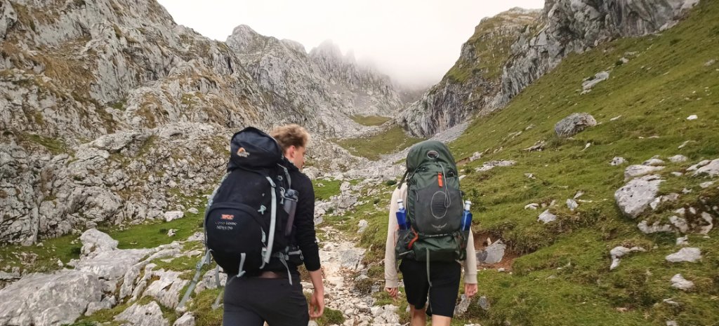
Anillo Vindio - Hut to Hut Around the Western Picos
- Starts / Finishes: Lagos de Covadonga (circular; can also be joined at Caín or Cordiñanes, or Soto de Sajambre (Vegabaño hut))
- Distance: c.55–75 km (34–47 mi), depending on start point and variants
- Days: 4–5
- Grade: Demanding
- Best months: June to September
- Sleep in: Staffed mountain refuges, small rural hotels (in Cordiñanes or Posada de Valdeón)
- Waymarking: Partial - cairns across the high karst; carry a GPS track
The Anillo Vindio is a hut-to-hut ring around the Western Massif of the Picos de Europa, in Asturias and León. It's one of three rings in the wider El Anillo de Picos network. There's no single fixed itinerary - distances vary with where you start and which variants you take.
The Picos are limestone, and the high ground is a maze of jous - crater-like hollows carved by water - with little flat ground between them. The route drops from bare karst into beech and oak forest, follows the Cares Gorge, then climbs back to the high refuges.
The massif sits within Spain's first national park. The Montaña de Covadonga National Park, forerunner of today's Picos de Europa National Park, was created in 1918.
Best stretch: the ring from Lagos de Covadonga. This five-day version from the Lagos de Covadonga covers around 62 km. It stays at the Vegarredonda, Vegabaño and Vega de Ario refuges, with one night in the Valdeón valley, and includes the northern half of the Ruta del Cares.
The longest day is Vegarredonda to Vegabaño: 14.8 km, 920 m of ascent and 1,056 m of descent, around eight hours over broken, shadeless limestone. The other big effort is the steep climb from the Cares Gorge up the Canal de Trea to Vega de Ario.
"For me, the best month is September," says Ángel Álvarez, a route documentation specialist who has walked the ring. "There are far fewer people, the weather is usually good, and it doesn't usually rain much."
Need to know: Porous limestone holds little water, so springs are rare on the high ground - carry at least 1.5 litres per person per day and refill at each refuge. Fog is the main hazard, as the jous become disorientating fast. Refuges fill in July and August, and all rubbish must be carried out of the national park.
Insider tip: The Ruta del Cares wasn't built for walkers. It began as the maintenance path for a hydroelectric canal dug between 1916 and 1921, with more than 5.5 km of tunnels cut largely by hand. Around 300,000 people walk it every year - go early.
Keep your eyes peeled for: The grave of Pedro Pidal, Marqués de Villaviciosa, at the Mirador de Ordiales (ES - Asturias.com), a short detour from Vegarredonda. Pidal secured the national park in 1918 and chose this 1,700 m viewpoint as his burial place.
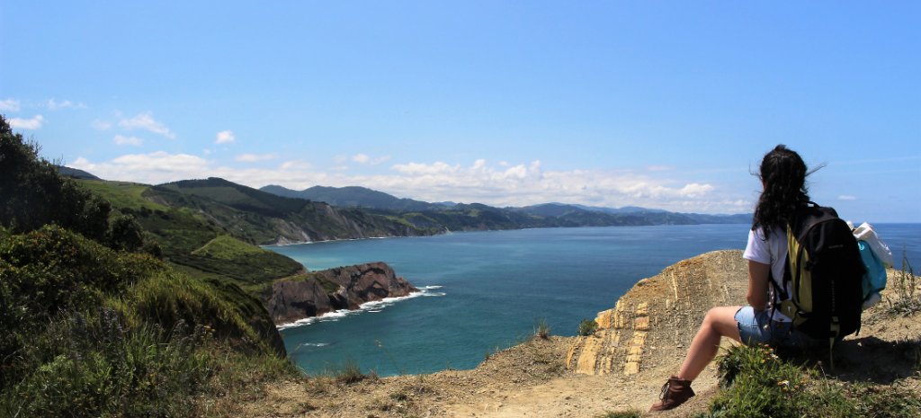
Camino del Norte - Spain's Green Atlantic Coast
- Starts / Finishes: Irún / Santiago de Compostela
- Distance: c.825 km (513 mi)
- Days: 32–36
- Grade: Challenging
- Best months: May–June and September–October
- Sleep in: Pilgrim albergues, pensiones and small hotels
- Waymarking: Yellow arrows and scallop shells
The Camino del Norte - the Northern Way - follows Spain's Atlantic coast from the French border through the Basque Country, Cantabria and Asturias, then turns inland across Galicia. It joins the Camino Francés at Arzúa for the final two days to Santiago.
Beaches, fishing ports and green headlands take the place of the Francés's inland plains, and pilgrim numbers are much lower. The Basque section is steep - among the hilliest walking on any major Camino - and there are long stretches of tarmac around the larger cities.
Best stretch: Irún to Bilbao. Six walking days from Irún to Bilbao cover around 160 km with some 4,200 m of ascent. This is the most coastal part of the route.
The route climbs the flanks of Mount Jaizkibel, crosses the Pasaia estuary by small ferry and drops into San Sebastián. Beyond Zarautz it passes through the Txakoli vineyards to Zumaia, where most walkers leave the official route for the GR-121 cliff path through the Flysch geopark to Deba - 1.5 km shorter than the inland route. Inland again, it passes Markina's hermitage of San Miguel de Arretxinaga, built around three huge boulders, then Gernika.
The longest day is the last: Gernika to Bilbao, up to 30.9 km. A short bus hop from Larrabetzu cuts out an industrial stretch but keeps the walk into the city.
Need to know: Carry a pilgrim credential to use the albergues and collect stamps along the way. Yellow-arrow signage varies from one province to the next, so download the stages before you set out.
Insider tip: The Vizcaya Bridge between Portugalete and Getxo, opened in 1893, is the world's oldest, and UNESCO-protected, transporter bridge (Unesco.org). Its gondola still crosses the river every eight minutes for under a euro, and lifts in the 50m towers take you up to the walkway on top.
Keep your eyes peeled for: A thin, dark band in the Zumaia cliffs. It's the K-Pg boundary (Wikipedia.org) - clay rich in iridium, laid down about 66 million years ago when an asteroid impact wiped out the dinosaurs and most marine life.
See our full Camino del Norte guide.
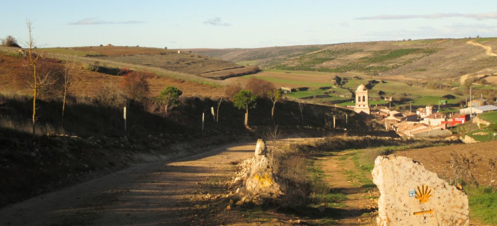
Le Puy Camino (Via Podiensis, GR-65) - Volcanoes, the Velay & the Aubrac
- Starts / Finishes: Le Puy-en-Velay / Saint-Jean-Pied-de-Port
- Distance: c.750 km (466 mi)
- Days: 27–34
- Grade: Moderate
- Best months: May–June and September
- Sleep in: Gîtes d'étape and chambres d'hôtes, usually on half board
- Waymarking: Red-and-white GR-65 marks and scallop shells
The Via Podiensis is the main French approach to the Camino de Santiago, running from Le Puy-en-Velay to the foot of the Pyrenees. At Saint-Jean-Pied-de-Port it feeds straight into the Camino Francés.
The route crosses the volcanic Velay, the granite Margeride and the high Aubrac plateau, then follows the Lot valley past Conques and Cahors. Most walkers stay in family-run gîtes, where dinner is often served at a shared table. It's generally quieter than the Francés, and hillier for most of its length.
Best stretch: Le Puy-en-Velay to Aumont-Aubrac. Four walking days from Le Puy to Aumont-Aubrac cover 92 km with around 2,000 m of ascent - the opening section of the route.
By tradition, walkers start at the cathedral door and head down the great steps into the old town. From there the trail crosses the Velay plateau, drops into the Allier gorge at Saint-Privat-d'Allier and climbs onto the Margeride. It enters Lozère at the Saint-Roch chapel and descends to Aumont-Aubrac, on the edge of the Aubrac.
The steepest day is Saint-Privat to Saugues: 19 km with 565 m of ascent, including a 420 m climb out of Monistrol-d'Allier. The longest is Saugues to Les Faux, at 28 km.
Need to know: Half board - dinner, bed and breakfast - is standard and worth taking. On the Saugues–Les Faux day, farm cafés are few and unreliable, so stock up in Saugues before you leave.
Insider tip: A pilgrim mass and blessing takes place at 7am each morning of the walking season in Le Puy cathedral, open to walkers of any faith or none. Look for the 'Pierre des Fièvres', the Fever Stone, a basalt slab in the south aisle that pilgrims have lain on for centuries (Lepuyenvelay-tourisme.fr).
Keep your eyes peeled for: A 10.5 m sequoia-wood Beast of Gévaudan above Saugues. The real "beast" killed more than 100 people across this region between 1764 and 1767, and was never conclusively identified (Gevaudan-authentique.com).
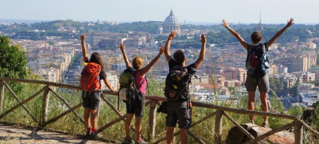
Via Francigena - Sigeric's Road to Rome
- Starts / Finishes: Canterbury / Rome
- Distance: c.2,000–2,200 km (1,240–1,370 mi), depending on route definition; the route now continues beyond Rome to Santa Maria di Leuca, c.3,200 km in total
- Days: Usually walked in sections over several trips
- Grade: Easy to moderate
- Best months: April–June and September–October
- Sleep in: Pilgrim hostels, agriturismi and family-run hotels
- Waymarking: White-and-red marks and pilgrim-symbol signs, most consistent in Italy
The Via Francigena follows Sigeric's route from Canterbury to Rome, crossing England, France, Switzerland and Italy. It has been a Council of Europe Cultural Route since 1994.
In Italy, waymarking is consistent, distances between towns are short and pilgrim hostels are well established. The Tuscan stretch runs through cypress lanes, vineyards and hill towns on the white gravel roads known as 'strade bianche'.
Best stretch: San Miniato to Siena. Five walking days from San Miniato to Siena cover around 93 km with about 1,700 m of ascent.
The route follows the strade bianche through the Val d'Elsa, past the Romanesque parish churches of Coiano and Chianni. It reaches San Gimignano on day two, then passes Monteriggioni and the abbey at Abbadia a Isola, founded in 1001. It enters Siena through the Porta Camollia, the city's historic pilgrims' gate.
The first day is the hardest: San Miniato to Gambassi Terme, 25 km with 780 m of ascent. The rest are shorter and gentler.
Need to know: A pilgrim credential gets you into the network of pilgrim hostels and collects stamps along the way. The strade bianche have little shade, so avoid July and August and start early.
Insider tip: The route's founding document is a travel diary. Sigeric, Archbishop of Canterbury, recorded 80 overnight stages on his journey home from Rome around 990, and the modern Via Francigena follows his list.
Keep your eyes peeled for: Monteriggioni's ring of towers (Monteriggioniturismo.it). Dante compared the giants guarding the last circle of Hell to them in Canto XXXI of the Inferno.
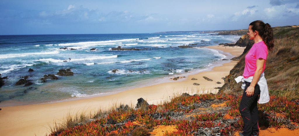
Fishermen's Trail - Portugal's Wild South-West Coast
- Starts / Finishes: São Torpes / Lagos
- Distance: 226.5 km (141 mi)
- Days: 13 stages, usually 12–14 days
- Grade: Moderate to challenging
- Best months: September and October (walkable September–June)
- Sleep in: Guesthouses and small hotels - wild camping is prohibited
- Waymarking: Blue-and-green Rota Vicentina marks
The Fishermen's Trail - the Trilho dos Pescadores - is the coastal route of the Rota Vicentina, a 750 km network of footpaths in south-west Portugal. It follows the paths fishermen used to reach the sea, and runs mostly within the Southwest Alentejo and Vicentine Coast Natural Park, where development along the shore is tightly limited.
The coast changes as you head south. The Alentejo half is exposed Atlantic - dunes, sheer cliffs and surf beaches. Past Cabo de São Vicente, the south-western tip of mainland Europe, the Algarve coast turns into sheltered coves where you can swim.
Cabo Sardão is known for its white storks, which nest on sea stacks and cliff ledges. It's thought to be the only place in the world where white storks nest on sea cliffs.
Best stretch: Porto Covo to Lagos. From Porto Covo, almost the whole trail runs south to Lagos in 12–13 stages. It's the way to see the coast shift from Alentejo cliffs to Algarve coves.
There are plenty of sights along the way: Fort São Clemente at Vila Nova de Milfontes, the stork cliffs at Cabo Sardão, the 12th-century Ribat of Arrifana - an Islamic fortress-monastery occupied for barely twenty years - and the red cliffs of Praia do Amado. The last days pass Cabo de São Vicente, Sagres and the sea arches of Ponta da Piedade.
The hardest day is Sagres to Salema: around 20 km of constant climbs on stony path, with an earlier finish possible at Figueira after about 16 km. Almograve to Zambujeira is just as long but much gentler, with only 175 m of ascent.
Need to know: Around 60-70% of the trail is sandy, so distances take longer than the numbers suggest. Parts of the coast near Carrapateira are only passable at low tide - check tide times and use the signed inland alternative when the water's in. After heavy autumn rain, some river crossings flood and diversions are marked.
Direct buses run from Lisbon to Vila Nova de Milfontes. Some family-run guesthouses close outside the summer season, so book ahead in autumn.
Insider tip: Time the southern stages for late September or early October. That's the peak of the autumn raptor migration over Sagres, when eagles, kites and vultures funnel around Europe's south-western corner on their way to Africa - more than 100 species can pass in a single good day.
Keep your eyes peeled for: A wooden trail sign near Praia do Telheiro, between Vila do Bispo and Cabo de São Vicente, that's permanently covered in snails. "Our team has walked past it more times than I can count, and it's never once been bare," says María Knaapen, who has been walking this coast for years. She's never found an explanation.
See our full Fishermen's Trail guide.
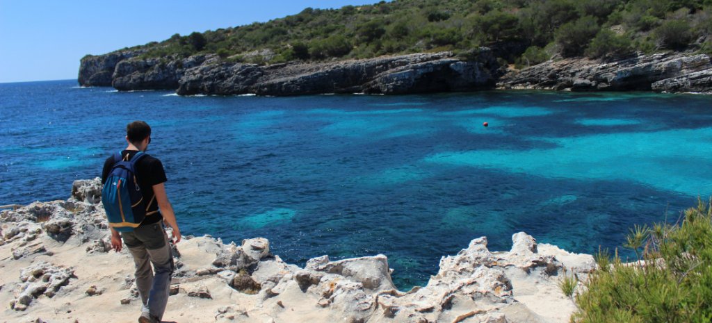
Camí de Cavalls - The Coast Path Menorca Won Back
- Starts / Finishes: Maó (circular)
- Distance: c.185 km (115 mi)
- Days: 20 official stages, usually combined into 9–12 days
- Grade: Moderate
- Best months: April–June and September–October
- Sleep in: Hotels and rural guesthouses
- Waymarking: GR 223 wooden posts, with a panel at the start of each stage
The Camí de Cavalls - "the horses' path" - is a footpath around the entire coast of Menorca. It is centuries old: documented by the 17th century and probably much older, it linked the island's watchtowers so guards could patrol for pirates. Menorca has been a UNESCO Biosphere Reserve since 1993.
The island's two coasts are very different. The north is dark, rocky and exposed to the Tramuntana wind. The south is limestone ravines and pine-backed coves with pale sand.
The trail stays clear of Menorca's larger resorts for most of its length. For long stretches, the only buildings in sight are old watchtowers and dry-stone field shelters.
Best stretch: the north and west coasts, Es Grau to Cala Galdana. Six walking days from Es Grau to the south coast cover around 90 km, with 200–460 m of ascent a day.
The route starts in the wetlands of S'Albufera des Grau Natural Park and passes the lighthouse at Cap de Favàritx. It crosses the island's roughest ground around Cap de Cavalleria, then the open farmland of the north-west, where Mahón cheese is still made on 17th- and 18th-century farms. Beyond Ciutadella it turns onto the south coast, past Talayotic remains and the coves of Son Saura and Cala en Turqueta, to Cala Galdana.
The stages are short, but rocky paths and wind make them slower than the distances suggest.
Need to know: There's little shade and few water sources between villages - carry plenty in spring and autumn, and avoid July and August.
Insider tip: The loop is walkable today thanks to a local campaign. After decades in which many sections were closed off, a citizens' movement that began in 1996 led to a dedicated law in 2000 and the full path's reopening to the public in 2010.
Keep your eyes peeled for: Torre de Fornells, a round defence tower built by the British in 1801–1802 to guard the mouth of Fornells harbour (Menorca.es). Menorca changed hands between Britain, France and Spain several times during the 18th century.
Menalon Trail - Mule Paths Through Mountain Arcadia
- Starts / Finishes: Stemnitsa / Lagkadia
- Distance: 75 km (47 mi)
- Days: 5–7
- Grade: Moderate to challenging
- Best months: April–June and September–October
- Sleep in: Village guesthouses
- Waymarking: Dedicated Menalon Trail waymarks
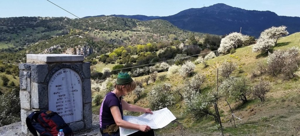
The Menalon Trail is a 75 km path through the mountains of Arcadia, in the central Peloponnese. It links nine stone-built villages at 1,000–1,500 m in eight official sections, following mule tracks that date back as far as the 16th century.
The landscape is fir-covered ridges, farmed valleys and village squares shaded by plane trees. The villages have long craft traditions - Stemnitsa has a school for silversmiths, Valtesiniko is known for woodcarving and Lagkadia for its stonemasons.
The trail begins in the Lousios Gorge, where Byzantine monasteries cling to the cliffs.
Best stretch: the whole trail, Stemnitsa to Lagkadia. Six walking days cover the full 75 km trail. Total ascent is close to 5,000 m, so short daily distances still involve steep climbs.
The first day drops into the Lousios Gorge past the Prodromou Monastery (Visitpeloponnese.com), built into a cliff face, and the Philosophou monasteries (Visitpeloponnese.com), the older founded in 963. Later days cross the stone bridge at Zarzi, reach the Sfyrida Hermitage in the pine forest, and follow a ridge past a ruined Byzantine fortress into Lagkadia.
The hardest day is Dimitsana to Elati: 19.5 km with 1,215 m of ascent, and the option to climb Pliovouni (1,643 m).
Need to know: Start at the Menalon Trail office on Stemnitsa's main square for maps and current trail conditions. Village fountains and springs are frequent, but summer heat in the gorge can be intense - spring and autumn are more comfortable.
Insider tip: The Menalon was the first trail in Greece certified by the European Ramblers Association, and is one of its "Leading Quality Trails – Best of Europe", a standard that covers path condition and waymarking.
Keep your eyes peeled for: Dimitsana's gunpowder mills (Dimitsana.gr). During the 1821 War of Independence, 14 of them worked day and night to supply the Greek fighters, earning the town the nickname "the Nation's powder keg". A restored mill is part of the town's Open-Air Water Power Museum.
Pieterpad - The Netherlands, Top to Toe
- Starts / Finishes: Pieterburen / Sint-Pietersberg, Maastricht
- Distance: c.500 km (310 mi)
- Days: 26 stages of roughly 15–22 km
- Grade: Easy
- Best months: April to October
- Sleep in: B&Bs, guesthouses and small hotels
- Waymarking: Red-and-white marks
The Pieterpad is the Netherlands' most popular long-distance walk, running the length of the country from the Wadden Sea coast to the southern tip of Limburg. Its name comes from its two end points - Pieterburen and the Sint-Pietersberg - and it opened in 1983.
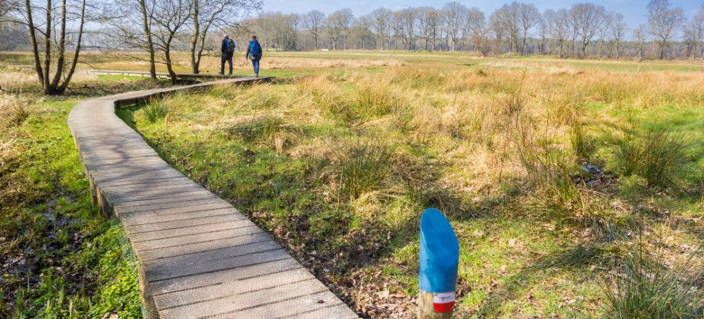
It's the gentlest walk on this list. The route crosses polder, heath, forest and glacial moraine, and passes the prehistoric tombs of Drenthe. The south is noticeably hillier, with the Nijmegen moraine and the marl country of South Limburg.
Most stages start and end near public transport, so the Pieterpad is easy to walk in weekends or week-long sections.
Best stretch: Pieterburen to Vorden. Thirteen walking days from Pieterburen to Vorden cover around 245 km - the northern half of the trail - on almost flat ground.
The route follows the dike along the Wadden Sea, crosses the Groningen countryside of mound villages and red-brick farms, and passes through Groningen city. It then enters the Drentsche Aa National Park and the Hondsrug, a UNESCO Global Geopark since 2015 (Unesco.org), before following the Vecht valley and the wooded moraine of the Sallandse Heuvelrug.
Need to know: The official guide comes in two volumes, divided at Vorden. Accommodation is plentiful, but some villages have only a handful of beds - book ahead in summer.
Insider tip: The Pieterpad was created by two friends, Toos Goorhuis-Tjalsma and Bertje Jens, who were 68 and 70 when it opened in 1983. A monument to them stands just outside Vorden.
Keep your eyes peeled for: Hunebedden - dolmens built around 3500 BC by the Funnel Beaker people. Fifty-four survive, 52 of them in Drenthe, made from boulders carried from Scandinavia by glaciers, some weighing up to 40 tonnes (Visitdrenthe.com).
Coast to Coast - Wainwright's Walk, Now a National Trail
- Starts / Finishes: St Bees / Robin Hood's Bay
- Distance: c.300 km (182–190 mi, depending on route version)
- Days: 13–16
- Grade: Challenging
- Best months: May to September
- Sleep in: B&Bs, inns and hostels
- Waymarking: National Trail acorn waymarks
The Coast to Coast crosses northern England from the Irish Sea to the North Sea. Alfred Wainwright devised it in the 1970s, linking three national parks: the Lake District, the Yorkshire Dales and the North York Moors.
In March 2026 it became England's newest National Trail. Natural England and its partners invested £5.5 million over four years in signage, bridges and path repairs.
The route comes with a ritual. Walkers dip their boots in the Irish Sea at St Bees, carry a pebble across the country, and drop it into the North Sea at Robin Hood's Bay.
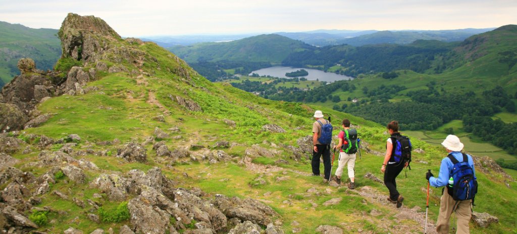
Best stretch: St Bees to Shap - the Lake District crossing. Five walking days from St Bees to Shap cover around 102 km, most of it through the Lake District.
The trail follows the cliffs of St Bees Head, climbs Dent and runs the length of Ennerdale Water. It then crosses to Honister Slate Mine - via Haystacks and Innominate Tarn, where Wainwright's ashes were scattered, or by the lower Loft Beck route. Beyond Borrowdale it crosses Greenup Edge to Grasmere and Grisedale Hause to Patterdale, with optional high-level variants over Helvellyn or St Sunday Crag.
The hardest day is Patterdale to Shap: 27 km with around 900 m of ascent, crossing Kidsty Pike (780 m), the highest point of the main route. It finishes past Shap Abbey, the last abbey in England to be dissolved, in 1540.
Need to know: Some villages, such as Orton, have very few beds - book early for summer. Save the high-level variants for clear weather; the valley routes are always available.
Insider tip: National Trail status brought 5 km of new flagstone path over the boggy Nine Standards Rigg above Kirkby Stephen, plus an accessible lakeside route around Ennerdale Water.
Keep your eyes peeled for: The ruins of Mardale Green beneath Haweswater. The village was flooded in the late 1930s to create a reservoir for Manchester, and its walls and lanes reappear when the water level drops in dry summers.
South West Coast Path - Cornwall's Far West
- Starts / Finishes: Minehead / South Haven Point, Poole
- Distance: 1,014 km (630 mi)
- Days: 7–8 weeks
- Grade: Challenging
- Best months: April–June and September
- Sleep in: B&Bs, inns and small hotels
- Waymarking: National Trail acorn waymarks
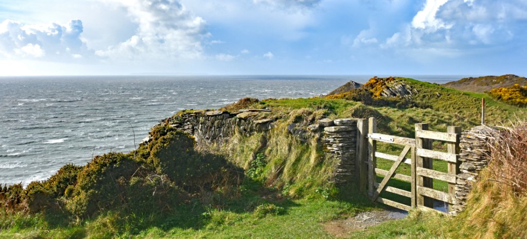
The South West Coast Path follows the coastline of Somerset, Devon, Cornwall and Dorset for 1,014 km. It involves some 35,000 m (115,000 ft) of ascent and descent - roughly four times the height of Everest.
England's highest sea cliff, the Great Hangman on Exmoor, comes in the first few days; the Jurassic Coast lines the finish. In between is Cornwall - granite headlands, fishing villages and the engine houses of its former tin and copper mines.
Best stretch: St Ives to Penzance, around Land's End. Six walking days from St Ives to Penzance cover around 71 km. Daily distances are short, from 6 to 15 km, but there's little level ground.
The route leaves St Ives along empty cliffs to Zennor, then passes Gurnard's Head and the mining coast around Geevor, part of the Cornwall and West Devon Mining Landscape World Heritage Site. It rounds Cape Cornwall and Land's End, passes the Minack Theatre at Porthcurno, and finishes through Mousehole and Newlyn.
The first day is the roughest: St Ives to Zennor, 12 km of steep dips and occasionally boggy ground.
Need to know: Buses link most villages on this stretch, so it's easy to shorten a day or skip the road walk between Mousehole and Newlyn. The Geevor mine is open for guided tours from March to October.
Insider tip: The Minack Theatre (Minack.com), cut into the cliffs above Porthcurno, was built largely by one woman. Rowena Cade began work in 1932, carrying sand up from the beach in sacks and etching patterns into the wet concrete with a screwdriver - and kept at it into her eighties.
Keep your eyes peeled for: The Cornish chough - a black crow with a curved red bill and red legs. It died out in Cornwall in 1973, returned on its own from Ireland in 2001, and now breeds again along this coast (BBC.com).
The well-known trails we left out
Some of Europe's best-known long-distance walking trails aren't on this list. Each is covered, in part, by a route above.
- Camino Francés, Spain: the most walked route. The Camino del Norte and the Le Puy route lead to the same destination with fewer pilgrims.
- GR20, Corsica: a mountain traverse with sustained scrambling. The Camí de Cavalls offers a Mediterranean island on foot, on much gentler terrain.
- West Highland Way, Scotland: a week-long walk from Milngavie to Fort William. The Coast to Coast is a longer crossing with a similar mix of mountain and moor.
- Alta Via 1, Italy: the Dolomites' best-known hut-to-hut route. The GR11 offers comparable high-mountain walking on a far less-travelled trail.
Frequently Asked Questions
- What is the best long-distance walk in Europe? It depends on the walker. For high mountains and hut-to-hut logistics, the Tour du Mont Blanc is the best-known circuit; the GR11 offers a longer, more remote Pyrenean alternative. For a pilgrimage, the Camino del Norte or the Via Francigena. For gentle, well-connected walking, the Pieterpad.
- What is the best long-distance walk in Europe for beginners? The Pieterpad in the Netherlands is the gentlest - flat, well waymarked and close to public transport. The Tuscan section of the Via Francigena and the Camí de Cavalls in Menorca are also good first multi-day walks.
- Which trails need the most mountain experience? The GR11 and the Anillo Vindio. Both cross high passes and rough limestone or boulder terrain, include nights in huts reachable only on foot, and demand careful navigation in poor visibility.
- Can you walk these trails without camping? Yes. All twelve trails have mountain refuges, guesthouses or inns along the way, so you can sleep under a roof every night.
- When is the best time to walk a long-distance trail in Europe? Spring and autumn suit most lowland and coastal routes. High mountain trails such as the Tour du Mont Blanc and the GR11 are usually snow-free only from late June or July to mid-September.
- Do you have to walk the whole trail? No. Every trail on this list can be walked in sections, and most people do. Each entry above suggests a section to start with.
- What is a quieter alternative to the Camino Francés? The Camino del Norte follows Spain's Atlantic coast with far fewer pilgrims. The Le Puy route in France and the Via Francigena to Rome are also good alternatives.
Like our pick of Europe's best long-distance walking routes? See our guide to perhaps the most renowned of them all - the Camino de Santiago.
Marketing, Web & Design
After studying in my hometown of Barcelona and spending several years abroad, I relocated in 2018 to Cabrales, a beautiful rural area in Northern Spain. I invite you to check out some photos of Cabrales to see the incredible views we enjoy from our office!
After a few years in reservations, I now manage the website and marketing for S-Cape Travel, where I handle design tasks, blog writing, and attend specialized travel fairs.
Most popular








Contact
-
Edificio Sovega bajo, Crta General s/n
33554 Arenas de Cabrales
Asturias , Spaininfo@s-capetravel.eu
+34 (0) 985 846 455
UK call free 0800 707 44 35 -





Opening hours: Mon-Fri 9:00am – 6:00pm (CET)
Opening hours: Mon-Fri 9:00am – 6:00pm (CET)