


The Best Hiking Routes in Picos de Europa
A Local Guide to the Top Hiking Trail Routes in the Picos de Europa
Find in this article a selection of routes to do in the Picos de Europa. They are classified by difficulty level and include links to download the GPS tracks.
Low difficulty

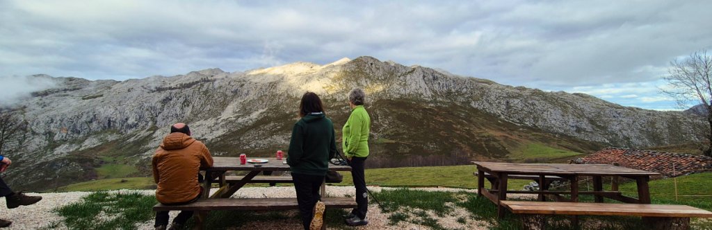
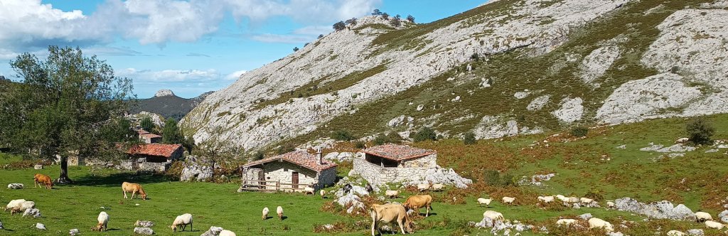
Lagos de Covadonga
Cangas de Onís, Asturias
A staple in Picos de Europa, go up to the Lagos de Covadonga and do this circular route around the lakes Enol and Ercina. It is very simple, perfect to do with the family, with stone shepherds' huts alongside grazing cows.
In rainy seasons you may encounter muddy stretches or dew in the mornings, so waterproof footwear is highly recommended.
- Distance: 2,7 or 5,5 km / 1.6 or 3.5 miles
- Elevation gain: ±200 m
- Time: 1 hour or 2,5 hours
- Track: Download the official PR-PNPE2 route here: short Itinerary / long Itinerary

Teleférico de Fuente Dé
From the area of Liébana, in Cantabria, 25 minutes by car from Potes.
Go by car (parking available) or by bus to Fuente Dé to take the cable car and climb 750m in just 4 minutes. If you go with your family, the kids will love the cable car ride. Once at the top, you can opt for a moderate route such as Horcados Rojos (described further down in this article) or go down to Hotel Refugio de Áliva, about 4 km / 2.5 miles away and take the cable car back up. Enjoy the high mountain scenery and the meadows of Áliva.
- Distance: 8 km / 5 miles (return trip)
- Altitude: ±370 m
- Time: 2 hours (return trip)
- Route: There is some signposting, but it is very easy to follow, as it is a single track. The official name is El Cable, which links the upper cable car station with Fuente Dé. When you reach the refuge, you only have to go back up the same way.
Refugio de La Terenosa
From Sotres, Cabrales, Asturias.
Although we are talking about a mountain hut, the Refugio de la Terenosa mountai hut is very easy to access, especially if you start your route in Pandébano. It is perfect for a walk in the Picos and a drink on the terrace of the refuge, or as a first mountain experience with the family. The route is very safe and children can run freely. If you follow the path, you will reach a second hut, the Urriellu hut (route described further down in this article).
- Distance: 3.5 km / 2 miles (round trip). If you want to extend the route but not the difficulty, you can start in the village of Sotres (13 km / 8 miles round trip).
Altitude: ±200 m - Time: 1 hour (return trip)
- Route: Very easy, without getting lost. When you reach Collado Pandébano you can take the signposted route to the right and, on the way down, follow the path to the other side to cross a stream just at the end. The river is very useful for cleaning your boots if it is muddy.
Would you like to do this route? Find the complete guide here!
Ancient village of Muniama and American oak forest
From Arenas de Cabrales, Cabrales, Asturias
If you’re in Arenas de Cabrales, this route is perfect for a morning walk. It’s a circular trail and you can do it in either direction, but if you happen to catch a hot day, it’s best to start through the oak forest. If you’re in the area in autumn, you can’t miss the blanket of leaves the trees leave behind.
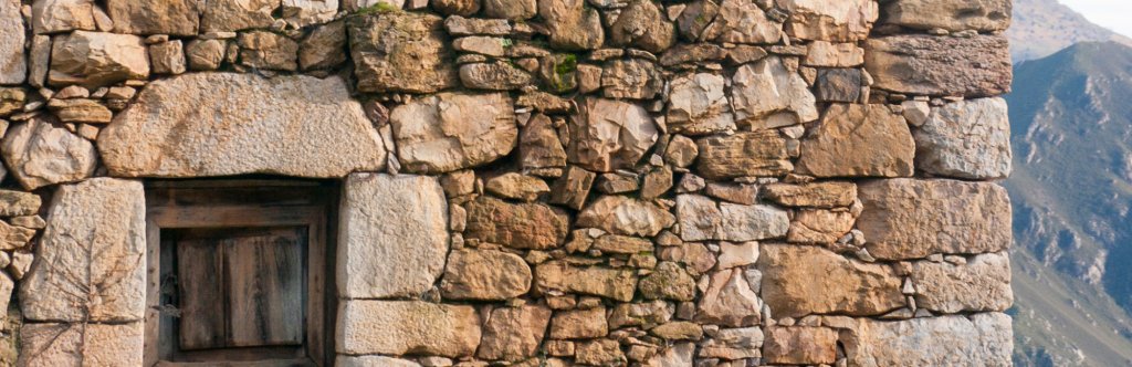
After the zigzag climb through the forest and the views over the River Cares, you reach the ancient village of Muniama, now a cluster of stone houses and cabins used for livestock. Take a moment to read the inscriptions and carvings left by shepherds to record their names.
- Distance: ±2 km
- Elevation gain: 250 m
- Time: 1.5 hours
- Route: Take the path to Invernales de Vanu/Muniama, which starts on the opposite side of the bridge where the Cabrales Cheese Museum is located. Before reaching the highest point, you’ll find a turn-off to the right towards Muniama. Once you pass the cabins, you’ll find a track that descends back to Arenas, offering views over the valley.
Moderate
Mirador de Ordiales (from Vega de Enol, Lagos de Covadonga)
Lagos de Covadonga, Cangas de Onís, Asturias
This route takes you to one of the best-known viewpoints in the Picos de Europa, the Ordiales viewpoint, a natural balcony with beautiful views of Amieva and Ponga. This route starts at the lakes of Covadonga and is perfect for extending the circular route around the lakes.
If you are travelling with children, this route is recommended for ages 9 and over due to the ascent and some rocky sections.
- Distance: 11,2 km / 7 miles (return trip)
- Time: 5.5 hours
- Altitude: ±641 m
- Track: you can download the PR 223 track here
Bulnes from Poncebos (through the Canal del Texu)
Cabrales, Asturias
This could be an easy route, but due to some exposed sections and the almost relentless ascent, it is classified as moderate. If it has rained, special care should also be taken as much of the route is cobblestone.
It is a beautiful route that takes you to an equally beautiful remote village, which can only be reached on foot or by funicular. Bulnes, with about 30 inhabitants, is like a fairy tale, with stone houses between mountains and forests, and a river that crosses the two neighbourhoods, the upper and the lower. It is an obligatory visit if you pass through Cabrales, and remember that you can always go up/down in the funicular.
- Distance: 6.7 km / 4 miles (outward and return)
- Elevation difference: ±421 m
- Time: 3.30 hours (outward and return)
- Route: very easy. Once in Poncebos, look for the start of the trail to Bulnes (you’ll see a stone bridge) and follow the path — it’s impossible to get lost.
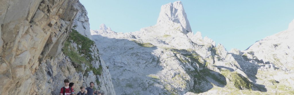
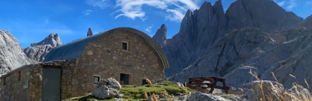
Refugio de Urriellu (from Pandébano)
Cabrales, Asturias
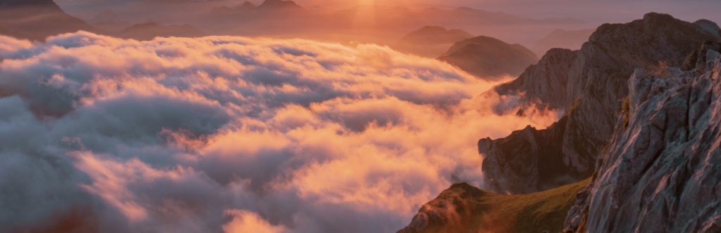
Another mythical route in Picos, walking to the base of Urriellu, the most emblematic peak of the Picos de Europa. This route starts from Pandébano, where you can park your car, or from the village of Sotres, adding an extra 4 km / 2.5 miles. It is a technically easy route but always uphill, 1,000m of ascent in 12km / 7.5 miles. When you get to Vega de Urriellu you can have a drink in the refuge, or even eat if they have availability. Now you have the option of returning to Pandébano or Sotres by the same route, all downhill, or spending the night in the refuge, surrounded by views of limestone formations, and the possibility of having breakfast above a sea of clouds.
- Distance: 12 km / 7.5 miles (one way)
- Time: 4 hours (one way)
- Elevation gain: ±1070 m
- Track: Download the official route PR-PNPE 21 here
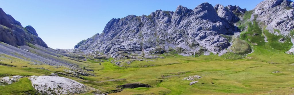
Ruta del Macizo de Ándara (from Sotres)
Massif shared between Asturias and Cantabria. Access from Jitu Escarandi (Sotres, Asturias) or from Bejes (Liébana, Cantabria).
The Ándara Massif is the smallest of the three massifs that make up the Picos de Europa. This route takes you through a wide variety of landscapes in the eastern massif, and allows you to discover the mining past of the area. The route is circular and, to avoid a climb on the last part, we recommend starting towards the Valdediezma beech forest. Halfway along the route you can rest in the casetón de Ándara, a mountain refuge (1,725m) with a bar service.
- Distance: 16 km / 10 miles (outward and return)
- Time: 4 hours (one way)
- Elevation gain: ±660 m
- Route: follow the official PR-PNPE 28 trail from Jitu Escarandi, in Sotres, right on the border between Asturias and Cantabria provinces
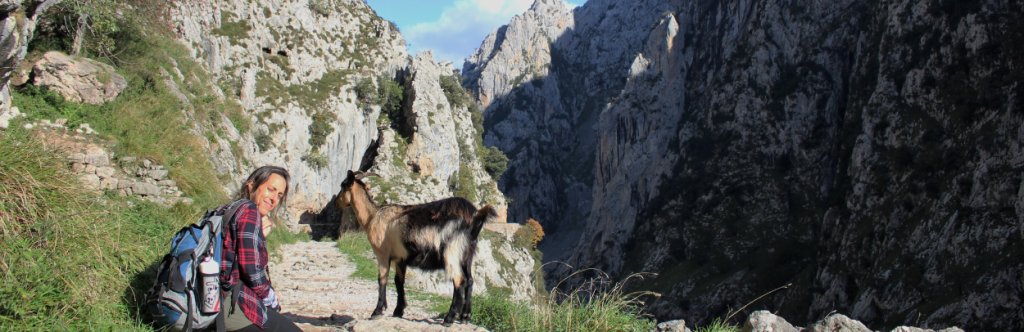
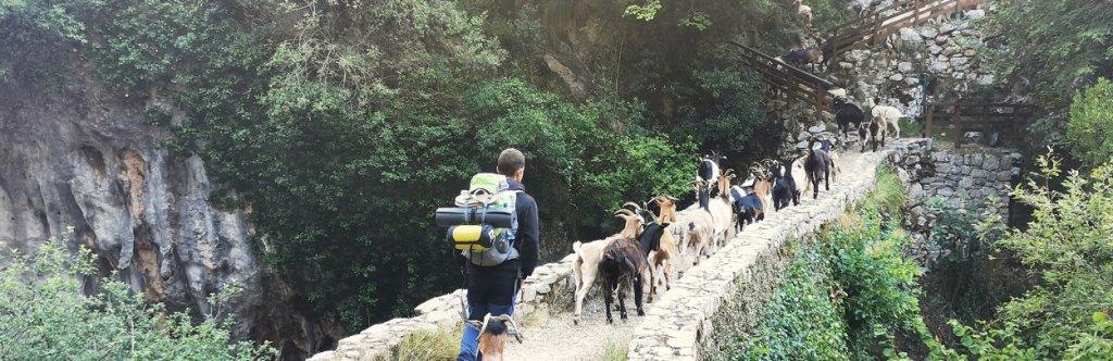
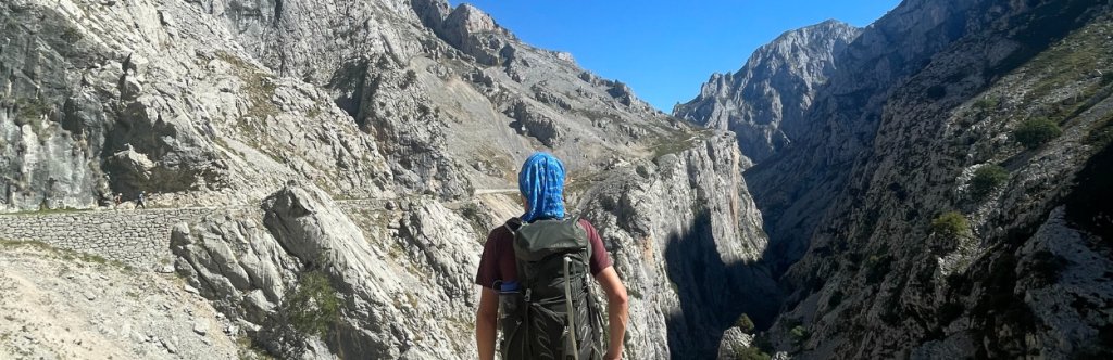
Cares Route (Poncebos – Caín – Poncebos)
Start in Poncebos (Asturias) or in Caín (León)
The Cares Route is the most famous trail in the Picos de Europa, known even internationally. It’s not difficult, but the out‑and‑back route is 24 km, and the first section, if you start from Poncebos, is quite a climb. Although it isn’t technically demanding, you do need to be careful, as in some stretches the drop down to the River Cares is very steep and the path relatively narrow. On hot days, make sure you bring enough water, as you’ll only find bars or restaurants in Poncebos or Caín.
- Distance: 24 km (return)
- Time: 3.5 hours
- Elevation gain: ±600 m
- Track: Download the official PR‑PNPE 3 route here

Horcados Rojos From Fuente Dé (Liébana, Cantabria)
To do this route, you’ll need to take the cable car up to the upper station at Fuente Dé, a 750‑metre ascent in just 4 minutes.
This is a linear route leading to the Horcados Rojos viewpoint, offering impressive views over the Picos and beyond. It isn’t a technical route until the final stretch, where you’ll come across a steep, rocky slope. The route ends at a mountain pass, although more experienced hikers will continue up to the summit.
- Distance: 11.4 km (return)
- Elevation gain: ±770 m
- Time: 4.5 hours (return)
- Track: Download the official PR‑PNPE 23 route here
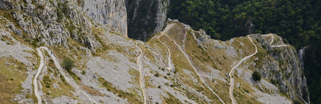
Tresviso from Urdón
Hermida Gorge, Cantabria
To reach the remote village of Tresviso, you have two options: a 30 km drive from Arenas de Cabrales along a winding uphill road, or a hike up from Urdón. The walking route is defined by its zigzags, which help you tackle the steep ascent. As with more than half of the routes in the Picos, it’s not suitable for anyone with vertigo due to the exposed sections.
In Urdón there’s space for just a few cars. If you arrive and there’s no room left, you can park in the village of La Hermida and walk along a path to Urdón.
- Distance: 11.6 km (return)
- Elevation gain: ±780 m
- Time: 4.5 hours (return)
- Track: Download the PR‑PNPE 30 route here
Find more details about this route here.
From Demués to the Soñín Pasture
From the village of Demués, Onís, Asturias
This linear route starts in the village of Demués, which you can easily reach by car by taking the turn‑off from the AS‑114 at Benia de Onís. It’s an easy route along a wide track, restricted to livestock vehicles, but it climbs over 600 metres in just a few kilometres. It offers panoramic views over the municipality of Onís and ends at the Soñín pasture, where you’ll find stone barns used by shepherds to tend their livestock.
- Distance: 7 km (one way)
- Elevation gain: 640 m (one way)
- Time: 3–3.5 hours
- Route: Download the KML track here
High difficulty
Collado Jermoso from Cordiñanes
Valdeón Valley, Cantabria
This route is one of the most demanding of the official trails in the Picos de Europa, as it climbs over 1,000 metres in just 5 kilometres, making it a true high‑mountain route. In adverse conditions, especially rain or fog, extra caution is essential. Most hikers climb up to Collado Jermoso to spend the night at the refuge of the same name and descend the following day. The views at sunset or sunrise over the central massif of the Picos will make you forget the effort of the ascent.
- Distance: 5.2 km (one way)
- Elevation gain: ±1,090 m
- Time: 5 hours (one way)
- Track: Download the PR‑PNPE 16 route here
If this route feels too tough, there’s an easier, obstacle‑free and very enjoyable alternative from Fuente Dé to the Collado Jermoso refuge. Find all the details here.
Jou de los Cabrones (from Poncebos)
A demanding route, with close to 2,000 metres of ascent and some technical sections. Starting from Poncebos, you climb towards Bulnes before reaching the Amuesa gully, where shepherds take their livestock during the summer months. The second half of the route is where things get tougher, with a steep ascent in a high‑mountain setting. Once at Jou de los Cabrones, you’ll find a mountain refuge, so you can climb up, spend the night, and descend the following day. You can also start the route from Bulnes. During peak season and weekends, it’s highly advisable to book the refuge in advance.
- Distance: 8.5 km (one way)
- Elevation gain: ±1,780 m
- Time: 5.45 hours (one way)
Very high difficulty
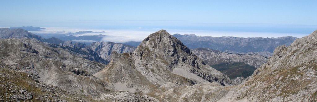
The Anillo Vindio hut to hut
Access from the Lakes of Covadonga (Cangas de Onís) or from Sajambre (León)
The Anillo Vindio is the easiest of the three circuits that make up the Picos de Europa Ring, and it’s designed to be completed in four stages (three nights in mountain refuges). You can already imagine the level of the most difficult circuit.
This is a pure mountain route, walking from refuge to refuge, eating above seas of clouds and under skies perfect for stargazing. The stages are tough due to the elevation gain and some technical sections, such as gullies with loose stones or steps where you’ll need to use your hands. However, on a couple of days you can reach your destination before lunchtime, giving you time to rest and enjoy the surroundings in the afternoon.
- Distance: 4 stages, a total of 63 km
- Elevation gain: total ascent of 3,900 m
- Route: Official route on Wikiloc: Wikiloc – Anillo Vindio
In this other article you’ll find the official tracks provided by the Picos de Europa National Park.
Marketing, Web & Design
After studying in my hometown of Barcelona and spending several years abroad, I relocated in 2018 to Cabrales, a beautiful rural area in Northern Spain. I invite you to check out some photos of Cabrales to see the incredible views we enjoy from our office!
After a few years in reservations, I now manage the website and marketing for S-Cape Travel, where I handle design tasks, blog writing, and attend specialized travel fairs.
Most popular


Contact
-
Edificio Sovega bajo, Crta General s/n
33554 Arenas de Cabrales
Asturias , Spaininfo@s-capetravel.eu
+34 (0) 985 846 455
UK call free 0800 707 44 35 -


Opening hours: Mon-Fri 9:00am – 6:00pm (CET)
Opening hours: Mon-Fri 9:00am – 6:00pm (CET)