






Hiking to Terenosa Mountain Hut in the Picos de Europa
A Route for Everyone
The hike up to the Terenosa Mountain Refuge (or Trenosa, as the locals call it) in the Central Massif of the Picos de Europa is one of the most rewarding trails for anyone looking for an easy walk or an introduction to hiking. It offers stunning panoramic views and a genuine taste of alpine adventure.
It is also a mandatory stop for hikers tackling the classic route between Pandébano and Picu Urriellu, as the trail passes right by its doors. The refuge terrace is the perfect spot to take in the views over a coffee or a cold drink, watch a sea of clouds roll in, catch the sunset, or stop for a hearty lunch.
Surrounded by traditional stone huts and grazing cattle, this refuge sits at an altitude of 1,315 m, offering a complete escape from the modern world despite being just a few kilometers from several villages in the Cabrales municipality of Asturias.
A Quick Look at Its History
Although it bore the sign of a "refuge" for years, it wasn’t until 2010 that it began operating fully as one, complete with a resident warden, meal services, and proper bunk beds. As with other mountain huts in Picos de Europa, the facilities have been steadily upgraded over the years. Today, alongside 20 beds and a restaurant service well-regarded for its quality, it offers running toilets and hot water.
Since its opening, it has become a popular gathering spot for experienced mountaineers, casual hikers, and beginners alike. It is a welcoming place where stories are shared among visitors and Emilio, the current warden, who is always happy to help you plan your next route.
-
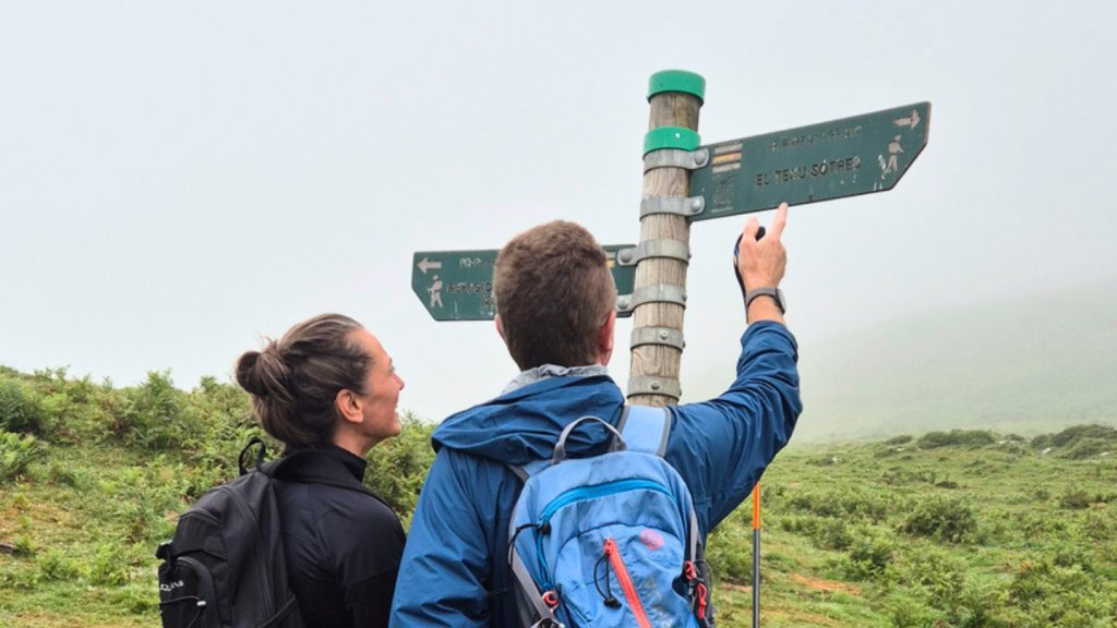
 A hiker pointing towards the village of Bulnes
 -
 Free-roaming horses in the Pandébano meadows
 -
 A rack of Crocs outside the dormitory
 -
 Just before arriving at the mountain hut
 -
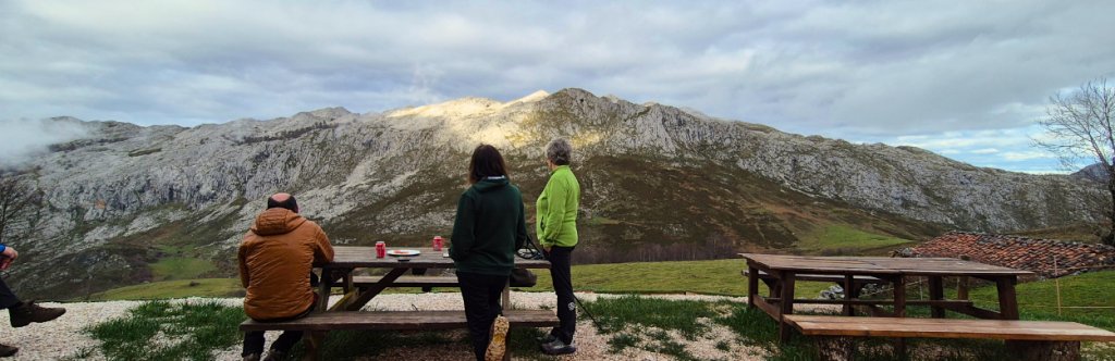
 Enjoying a drink on the mountain hut terrac
 -
 Stone shepherds' huts
Route Details
This is a low-difficulty route measuring less than 2 km one-way if you start from Pandébano (the alternative options are detailed below). It is perfectly suited for novice hikers and families accustomed to walking on uneven terrain. Furthermore, it serves as an excellent gateway for those looking to approach Picu Urriellu or returning from a longer trekking loop around the Picos.
| Standard Starting Point | Collado Pandébano (1,130 m) Google maps: maps.app.goo.gl/x7EpTeh |
| Distance | 1.8 km (one-way) / 3.6 km (round trip) |
| Refuge Altitude | 1,315 m |
| Elevation Gain | Approx. 200 m from Pandébano |
| Estimated Time | 40 mins – 1 hour (ascent only) |
| Terrain | Well-marked mountain trail with some uneven, non-technical sections |
| Best Time to Visit | Spring to Autumn (avoid winter snow conditions unless experienced) |
| Nearby Villages | Sotres, Tielve, Bulnes |
| Official Route & Track | PR-PNPE 21 Vega de Urriellu - download here the official track |
Another option for those seeking a more demanding challenge is to hike up from Poncebos via the beautiful village of Bulnes. The details of this alternative are explained at the end of the article.
How to Get to Pandébano (The Trailhead)
The easiest and fastest way to reach the trailhead is from Collado Pandébano, which is accessed via a dirt track branching off the AS-264 road, just 700 meters before the village of Sotres. However, access to this track is regulatedand features only 64 parking spaces, which fill up very early in the morning.
If you don't start early, you will have to hike up from Sotres instead. This adds 700 m of asphalt road, 4.3 km of dirt track, and an extra 350 m of elevation gain to your day.
By public transport, there is only a shuttle service between Arenas de Cabrales and Sotres during the high season. The rest of the year, travel must be by private car or taxi.
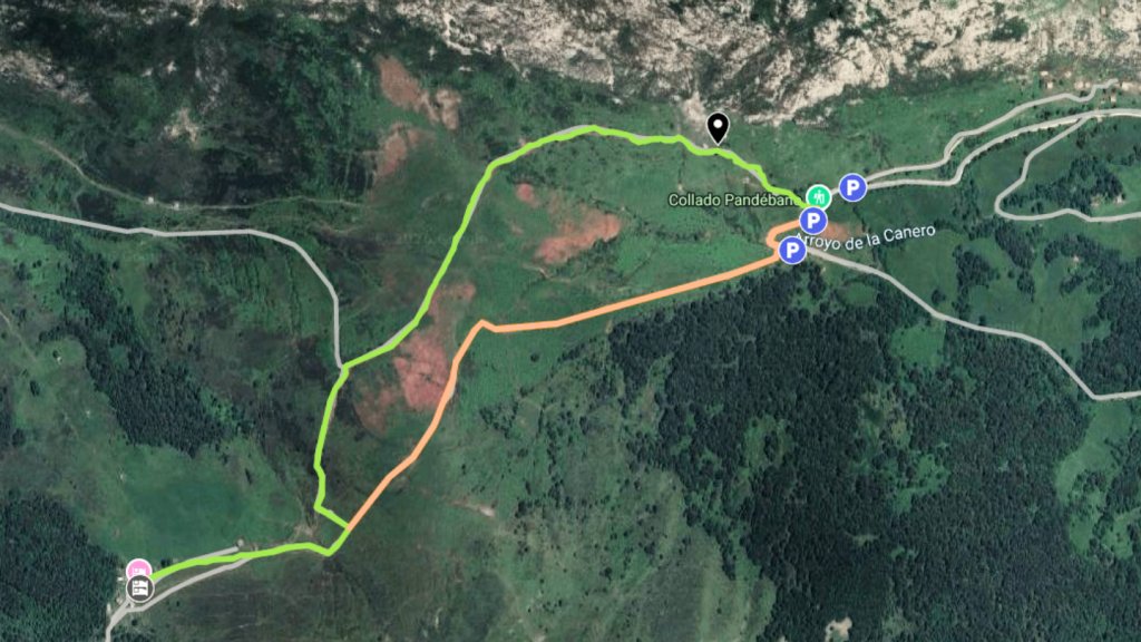
Standard Access Points
From Collado Pandébano:
Regulated parking with 64 designated spaces along the track. It is mandatory to park only in these marked spots to avoid heavy fines, as National Park rangers regularly patrol the area. Note: The track is uneven and low-clearance cars may scrape the underbody in several sections, especially after heavy rains.
From the Village of Sotres:
If the parking spaces are full, you must start your hike from Sotres. This adds 700 m of road walking and 4.3 km along the track, with 350 m of vertical climb. Local taxi services are available to take you up to Pandébano, though booking in advance is highly recommended during peak season.
Step-by-Step Route Guide
The trail is highly intuitive, easy to follow, and gets you to the refuge from Pandébano in under an hour. This makes it an ideal option for families introducing children to hiking, allowing younger walkers to reach a mountain refuge on their own two feet, with the added excitement of spending the night there.
From the Pandébano parking area, you will see two clear paths climbing through the meadows. We recommend taking the right-hand path for the ascent, as you will naturally follow the other one on your way back down.
Following the right fork brings you past the stone huts of Canero, where you will regularly see cows grazing peacefully—a quintessential scene of rural life in the Picos.
In less than a kilometer, the two paths merge. From this point on, simply follow the clearly defined trail straight to the refuge. The views open up magnificently toward Sotres on one side and the dramatic limestone peaks of the massif on the other. On clear days, you might witness a spectacular sea of clouds blanketing the Bulnes valley below. A photo here is a must.
The refuge eventually comes into view at the Majada de la Terenosa, a cluster of ancient shepherds' huts. While few active shepherds remain today, livestock farming is still very much alive, and several huts are carefully maintained to preserve the local heritage.
Extend Your Hike to View Picu Urriellu
If you feel like walking a bit further, you can continue for an additional 2 km with an extra 200 m of climbing along the main path to the point where the iconic Picu Urriellu (Naranjo de Bulnes) first comes into view.
The effort is entirely worth it to capture the classic postcard shot of this legendary peak.
Return Route
The descent follows the alternative path running alongside a small mountain stream. If it is running with water, it makes for a lovely spot to cool off or rinse your boots if the ground was muddy.
The Terenosa Refuge: Booking & Services
- Capacity: 20 beds (bunk bed style)
- Season: April 1st – October 31st (the bunk room remains open for emergencies during the rest of the year)
- Catering: Breakfast, lunch, dinner, and bar/cantina service
- Facilities: Shared toilets, hot water, communal dormitory rooms
- Warden: Emilio Huerta Alonso
- Contact: +34 630 552 016
- Reservations: www.reservarefugios.com/es/refugios/terenosa
- Location in Googlemaps: maps.app.goo.gl/eAHFMqn
Rates (2026)
| Alpine Club Members (Federated) | Non-Members |
| Breakfast €8 | Breakfast €8 |
| Lunch / Dinner €19 | Lunch / Dinner €19 |
| Overnight Stay €15 | Overnight Stay €20 |
Alternative Route from Poncebos
If you are looking for a longer and more challenging route without technical difficulties, consider hiking up to the Terenosa Refuge from Poncebos, passing through the beautiful, isolated village of Bulnes (which can only be reached on foot or via a funicular railway). Starting from Poncebos—where you can park if you arrive early or catch a shuttle bus from Arenas de Cabrales—the trail is marked as the GR-202.
This itinerary takes approximately 2 hours 50 minutes to 3 hours, climbing a steady 1,000 m over a distance of 7.5 km. It is a thoroughly rewarding journey through varied landscapes: starting in the deep Cares Gorge, passing through Bulnes, climbing through woodlands and past pastoral huts, before finally emerging into the wide-open alpine landscape of the Majada de la Terenosa.
Practical Information
Recommended Gear
Sturdy hiking shoes are recommended, though standard trail running shoes or sneakers are sufficient if the ground is completely dry. On sunny days, sun protection is vital as there is no shade along the trail until you reach the refuge. There is no need to carry heavy amounts of water, as you can refill your bottle at the public fountain right by the refuge.
While the route is straightforward, it is always wise to carry a GPS track if you plan to explore beyond the refuge or if mountain mist rolls in.
Weather Conditions
This route is perfectly suited for the warmer months. While you won't find any shade until you reach the refuge, the short distance keeps it highly manageable.
Best Season: May to October. Avoid winter conditions if you lack experience. If thick fog sets in, it is best not to venture out unless you are an experienced navigator; while the trail is distinct, heavy mountain mist can easily disorient even the locals.
Livestock and Dogs
The trail passes through active summer pastures. It is common to encounter cows, donkeys, goats, and livestock guardian dogs (Mastiffs). They pose no danger if you act calmly: slow down your pace, give the animals a wide berth, and always keep your own dogs on a short leash. Do not run or shout. Remember that these guardian dogs are working to protect their herds.
Who Is This Hike For?
It is perfect for beginner hikers and families with young children. The incline is gentle and consistent, and the refuge provides excellent amenities at the halfway point. It is also an excellent option for a quick morning walk or an afternoon stroll if you are staying in the surrounding valley.
Conclusion
The hike to the Terenosa Mountain Refuge is the perfect way to experience the essence of the Picos de Europa without requiring peak physical fitness. It beautifully combines local history, dramatic landscapes, and pastoral traditions. By extending your walk just 2 km further, you will be rewarded with your first glimpse of the mythical Picu Urriellu. A short hike, but one packed with true mountain character.
Organize Your Trip
Essential Pre-Hike Checklist
Check the Weather: Mountain weather in Picos de Europa can change rapidly. Always check local high-altitude forecasts before leaving Sotres.
Cash is King: While some refuges accept cards, connectivity can be unreliable in the mountains. Carry enough cash for your meals or drinks.
Leave No Trace: You are hiking through a protected National Park. Bring a small bag to pack out all your trash, including organic waste like fruit peels.
Tips for Staying Overnight at the Refuge
Pack a Sheet Sleeping Bag: The refuge provides blankets and mattresses, but a lightweight liner or sheet sleeping bag is mandatory for hygiene.
Bring Headlamps and Earplugs: Dormitories are shared. A headlamp helps you navigate at night without waking others, and earplugs ensure a good night's sleep.
Respect Quiet Hours: Mountain etiquette dictates quiet hours starting around 10:00 PM to accommodate hikers waking up at dawn.
We help you organise your routes in the Picos. And if you’re travelling with your family, take a look at this family trip in the Picos, for boys and girls aged 8 and over.






Contact
-
Edificio Sovega bajo, Crta General s/n
33554 Arenas de Cabrales
Asturias , Spaininfo@s-capetravel.eu
+34 (0) 985 846 455
UK call free 0800 707 44 35 -





Opening hours: Mon-Fri 9:00am – 6:00pm (CET)
Opening hours: Mon-Fri 9:00am – 6:00pm (CET)