


Find your perfect trip!
Find your perfect trip!


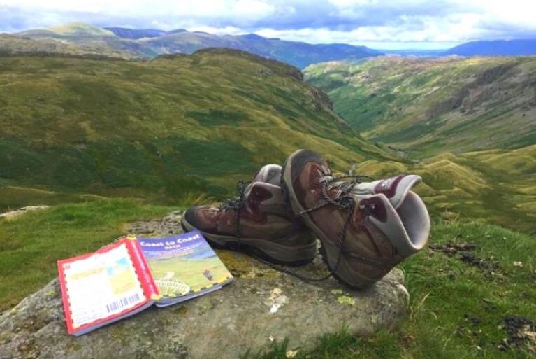
18-day Coast to Coast Path Walking Holiday
18-day Coast to Coast Path Walking Holiday
style :
Level :


Duration :
18 days
Comfort :


period:
Apr May Jun Jul Aug Sep Oct
Code:
UKSW001

18-day Coast to Coast Path Walking Holiday
18-day Coast to Coast Path Walking Holiday
From the Irish Sea at St.Bees Head to the North Sea
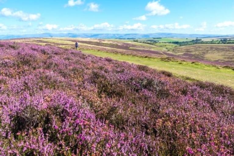
- A walk crossing three National parks: The Lake District, The Yorkshire Dales and The North Yorkshire Moors
- Memorable mix of valleys, plains, mountains, dales & moors
- Historical elements including St Bees Lighthouse, Honister Slate Mine,Ullswater Steam Ferry
- Lake District Stone Walls & Barns
- Vibrant walkers' towns Robin Hood’s Bay with its Jurassic Cliffs
- Too long? The western and eastern sections also available

View map
ITINERARY
Start: St Bees Finish: Robin Hood's Bay
Day 1: Arrival in St Bees
Day 2: St Bees to Ennerdale Bridge (23 km / 14 mi)
Day 3: Ennerdale to Rosthwaite (23 km / 14 mi)
Day 4: Rosthwaite to Grasmere (15 km / 9 mi)
Day 5: Grasmere to Patterdale or Glenridding (14 - 17 km / 9 - 10,5 mi)
Day 6: Patterdale or Glenridding to Shap (27 km / 16.7 mi)
Day 7: Shap to Orton (12 km / 7.5 mi)
Day 8: Orton to Kirkby Stephen (20 or 24 km / 12.4 or 15 mi)
Day 9: Kirkby Stephen to Keld (19 km / 12 mi)
Day 10: Keld to Reeth (19 km / 12 mi)
Day 11: Reeth to Richmond (19 km / 12 mi)
Day 12: Richmond to Danby Wiske (22 km / 13.7 mi)
Day 13: Danby Wiske to Osmotherley (18 km / 11 mi)
Day 14: Osmotherley to Clay Bank Top (18 km / 11.2 mi)
Day 15: Clay Bank Top to Blakey (14 km / 8.7 mi)
Day 16: Blakey to Grosmot/Egton (18 or 21 km / 11.2 or 13 mi)
Day 17: Grosmont or Egton to Robin Hoods Bay (24 or 27 / 15 or 16.8 mi)
Day 18: Departure from Robin Hoods Bay
Day 1: Arrival in St Bees
Arrival in St Bees via train – routes available from all major airports.
St Bees includes St Bees Head, the most westerly point of Cumbria, on the coastal strip between the Lakeland fells and the Irish Sea. It has a history going back over 1,000 years and has been a popular holiday destination for over 150 years.
Day 2: St Bees to Ennerdale Bridge (23 km / 14 mi)
Before setting off this morning, follow the tradition of all coast to coast walkers, and collect a stone from the beach in St. Bees, which you will carry to Robin Hood’s Bay on the North Sea.
Set off along the coast before turning inland towards the village of Sandwith. Once you’ve passed through the sleepy villages of Moor Row and Cleator, you reach the first climb of the trip – Dent Fell - before arriving at the small village of Ennerdale Bridge.
Challenge: 23 km / 14 mi, 6 hrs, 900 m ascent, 800 m descent
Day 3: Ennerdale to Rosthwaite (23 km / 14 mi)
You are now in the Lake District National Park and the day starts with a walk along Ennerdale Water with superb views of the approaching fells.
From here, you have a choice: either go high up to Red Pike and over High Stile onto the iconic Haystacks and past Inominate Tarn (where Wainwright’s ashes were scattered) or follow a gentler route up to Black Sail Youth Hostel and then up Loft Beck. Both routes take you to Honister Slate mine – the last working slate mine in England - before a descent into the village of Rosthwaite followed by Stonethwaite (both located in the Borrowdale Valley).
Challenge: 23 km / 14 mi, 8hrs, 1028 / 1044 m ascent
Day 4: Rosthwaite to Grasmere (15 km / 9 mi)
A shorter stage today, but the ascent to the day's only peak, Greenup Edge, is steep and demanding. The view from here is another iconic picture of the unique and beautiful landscape of the Lake District. Overnight in pretty Grasmere where there is lots to explore including the Wordsworth Museum and the poet’s former residence, Dove Cottage.
Challenge: 15 km / 9 mi, 5.5 - 6 hrs, 547 m ascent, 563 m descent
Day 5: Grasmere to Patterdale or Glenridding (14 - 17 km / 9 - 10,5 mi)
All walkers climb up to Grisedale Hause with gorgeous views back towards Grasmere. From here, you have the option to go even higher and up the famous Helvellyn peak or St Sunday Crag – with far reaching views as far as Ullswater – before coming down Grisedale into Patterdale. Alternatively, take the direct route down Grisedale to the village of Patterdale.
Challenge: 14 - 17 km / 9 - 10.5 mi, 6 - 7 hrs, 541 m ascent, 458 m descent
Day 6: Patterdale or Glenridding to Shap (27 km / 16.7 mi)
The day starts with another climb and impressive panoramic views across to Fairfield, Helvellyn, Hartsop and Kirkstone Pass. You continue beside Angle Tarn, across the old Roman path of High St and onto Kidsty Pike – at 780m, the highest point on the Coast to Coast Walk. From here there are amazing views down to Haweswater and Riggindale. Descend to Haweswater – formed in the 1930’s to provide water to the cities of the North West – for an undulating onward walk through the charming village of Bampton and continuing past Shap Abbey, the ruins of a monastery founded in the 13th century. The monks abandoned it to Henry VIII in 1540 and since then it has served as a memory of a bygone era. A short distance to the village of Shap.
Challenge: 27 km / 17 mi, 7.5 hrs, 900 m ascent, 798 m descent
Day 7: Shap to Orton (12 km / 7.5 mi)
From Shap, you cross the busy road and rail routes before tranquilly passing through the high moors. There follows a hilly section across limestone scarps with limestone pavements in places strewn with ‘erratic’ granite boulders moved there by glaciers. Due to there being limited accommodation in Orton, you might be staying at the excellent Westmorland hotel. To reach this you descend off Wainwright’s route along an old roman road off Crosby Ravensworth Fell, before making your way to your accommodation.
Challenge: 12 km / 7.5 mi, 4 - 5 hrs, 226 m ascent, 250 m descent
Day 8: Orton to Kirkby Stephen (20 or 24 km / 12.4 or 15 mi)
Today is a bridging day between Cumbria and the Yorkshire Dales National Park. You start your day in Orton, a quaint picturesque village with Kennedy’s Chocolate factory to lead you into temptation and stock up on snacks for the day. From here you walk through open countryside and farmland walking, with a section of moors and a wide panorama towards the distinctive Howgills and the distant Pennines (tomorrow’s challenge!). Passing Sunbiggin Tarn, which is an important site for birds, a steep descent to the Scandal Beck at Smardale Bridge makes for a nice lunch stop, with excellent views of the Victorian viaduct.
Continue to ascend over Smardale Fell for the pretty descent into Kirkby Stephen. This is an attractive market town, with St. Hedda’s Church containing the 8th Century Loki stone relating to Norse mythology.
Challenge: 20, 6 - 7 hrs, 290 m ascent, 350 m descent
Accommodation: If you stay in Westmorland Hotel, the stage is 24 km/15 mi
Day 9: Kirkby Stephen to Keld (19 km / 12 mi)
Climb out of town to the cairns of Nine Standards Rigg (661m / 2170 feet) with its array of obelisks. This is an ancient, possibly, boundary feature that no one has any real knowledge of. It marks the Watershed of England. Next you cross squelchy moors down to Keld in Swaledale. You might relish a scone & tea made on the farm at Ravenseat, where they also breed prime rams. The moors then become increasingly gentler as you walk into Keld with its many waterfalls and old stone barns.
Challenge: 19 km / 12 mi, 5 - 6 hrs, 534 m ascent, 385 m descent
Day 10: Keld to Reeth (19 km / 12 mi)
Today you have the choice between a route over the mountain, or the lower route along the valley.
The former crosses a remote landscape of grouse moors, dotted with ruins from the lead-mining era; the latter takes you via heather clad Swaledale, with its traditional stone barns and drystone walls. Whatever you choose, you arrive in Reeth, another quintessential Dales village with cosy pubs.
Challenge: 19 km / 12 mi, 5.5 hrs, 459 m ascent, 573 m descent
Day 11: Reeth to Richmond (19 km / 12 mi)
Today's more leisurely stage takes you across verdant meadows and through pretty villages. Take timeto explore Marrick Priory, a 12th century Benedictine nuns’ monastery, abandoned during the 16th-century religious wars. Overnight in the pretty market town of Richmond, with its quaint cobbled streets and imposing Norman Castle.
Challenge: 19 km / 12 mi, 5 hrs, 290 m ascent, 344 m descent
Day 12: Richmond to Danby Wiske (22 km / 13.7 mi)
An easier, flatter walk again today, taking you across the Vale of Mowbray, through fertile farmland and along quiet country lanes, via Bolton-on-Swale and its 14th century St. Mary's Church. Your final destination is Danby Wiske, a cluster of pretty houses huddled around the village green.
Challenge: 22 km / 13.7 mi, 6 hrs, 77 m ascent, 172 m descent
Day 13: Danby Wiske to Osmotherley (18 km / 11 mi)
Continue your approach towards the North York Moors National Park – and its hills! - along flat footpaths and farm tracks, passing brightly coloured rapeseed fields and sleepy livestock.
Depending on accommodation availability, you overnight in either Ingleby Cross or Osmotherley.
Challenge: 18 km / 11 mi, 5 hrs, 232 m ascent, 102 m descent
Day 14: Osmotherley to Clay Bank Top (18 km / 11.2 mi)
This walk is a real roller coaster. A steep stretch from Osmotherley introduces you to the North York Moors, with its sandy, heather-clad hills and patches of forest. After descending from Scarth Wood Moor, there’s a long ascent up Live Moor and Carlton Bank (408m), before heading down to Lord Stones Café. Almost hidden in an off-road embankment, the café offers a welcome stop for coffee.
From here, you tackle a series of climbs over Cringle Moor, Broughton Bank, and White Hill – all at or above 400m. Between each, you lose and regain 100-200m in elevation. White Hill features an area of sandstone boulders known as The Wainstones, which you’ll navigate on the ascent. In clear weather, you’ll be treated to fantastic views, including Roseberry Topping, the Vale of Mowbray, and back towards the Pennines.
The walk finishes as you descend from the ridge at Clay Bank Top, where you will be picked up for a transfer (included) from the car park to your accommodation in Great Broughton.
Challenge: 18 km / 11.2 mi, 6 - 7 hrs, 716 m ascent, 598 m descent
Day 15: Clay Bank Top to Blakey (14 km / 8.7 mi)
You will be transferred back to the car park (included). Today, the walk follows a moorland ridge up over Round Hill (454m) and the track maintains its height as it follows the line of the old dismantled Rosedale Railway line. The moor can be bleak in bad weather and is punctured in places by standing stones, some marked with inscriptions. There are enticing views at times into the fertile upper valleys of Farn and Esk dales, but your arrival at the ancient Lion Inn at Blakey can be a great relief.
Challenge: 14 km / 8.7 mi, 4 - 5 hrs, 238 m ascent, 114 m descent
Day 16: Blakey to Grosmot/Egton (18 or 21 km / 11.2 or 13 mi)
After a brief road walk past a white cross known as Fat Betty, you follow an easy, undulating descent down to the beautiful wooded Eskdale. As you descend, you’ll also begin to see views opening up towards the sea. The latter part of today’s walk takes you along a charming path through woodlands on the banks of the River Esk. Along the way, you’ll encounter ‘Beggars Bridge,’ a parabolic stone structure with a romantic tale of love lost and found.
Egton Bridge boasts a church containing relics of the Catholic martyr Nicholas Postgate. The setting is picturesque, and the river here is famous for fly fishing. It also features intriguing stepping stones, allowing you to hop between the two local pubs more quickly than taking the road. Depending on accommodation availability, you might stay in Egton tonight. Otherwise, you will follow the river to the small town of Grosmont.
Accommodation – While accommodation is located in Grosmont, depending on availability you may be staying in Egton. You have two options here: either stop in Egton as you pass through, or continue the 3km along the river to Grosmont and catch the train back to Egton, reversing this journey the next morning to make the next section of your walk shorter.
Challenge: 18 km / 11.2 mi, 6 hrs, 145 m ascent, 500 m descent
Day 17: Grosmont or Egton to Robin Hoods Bay (24 or 27 / 15 or 16.8 mi)
Start the day with a steep road climb up onto the moor before descending into beautiful Littlebeck – but not before catching a glimpse of the sea and the breathtaking Whitby Abbey! Through Falling Foss woods with its hidden follies, walk over the last section of the Moors. The final stretch takes you from High Hawsker along the top of the Jurassic cliffs – with stunning coastal scenery and the sight of a dolphin if you’re lucky. There are gorgeous vistas of Robin Hood’s Bay as you descend to this beautiful old fishing village.
On arrival, don’t forget to throw your St Bees’ stone into the North Sea. Congratulations - You've crossed England!
Challenge: 24 km / 15 mi, 7 hrs, 570 m ascent, 600 m descent
Day 18: Departure from Robin Hoods Bay
PRACTICAL INFO

This program can be booked any day between April and September, subject to availability. We recommend that you start your walk between Saturday and Tuesday as many of the Lake District accommodations stipulate a minimum 2 night stay at the weekend.
IMPORTANT UK ENTRY VISA INFORMATION
All non-UK nationals travelling to or transiting through the UK now need to obtain an Electronic Travel Authorisation (ETA). Click here for information and how to apply.
This normally takes 3 working days.

The nearest international aiport to fly to is Manchester

Getting to St Bees
You can get to St Bees via train, you can use the main line from any of the airports. Most walkers travel to Manchester airport then take the train to St Bees by changing at South Lakes or Carlisle.
The alternative is to travel via car to Kirkby Stephen and use the free car parking available. You will then stay overnight in Kirkby Stephen rather than St Bees. A transfer will then leave the following morning to take you to the start of the route.
Return from Robin Hood's Bay
When you reach Robin Hoods Bay, you can take a taxi or a bus to nearby Scarborough to access the trainline. If you have parked in Kirkby Stephen, there is a transfer provided every afternoon to return you to your car.

GPS tracks are available on request.
WHAT'S INCLUDED
Included
- 17 nights' accommodation (small hotels, lodges, pubs, and B&Bs)
- 17 breakfasts
- One piece of luggage per person transferred between your accommodation daily, not exceeding 18kg
- Digital detailed route descriptions and maps
- Access to the trip on GUIBO navigation app
- 24-hour telephone assistance
Not included
- Dinner, lunch and drinks
- Travel to the start and from the end point of the trip
- Admission fees
- Personal expenses such as laundry and phone calls
- Unscheduled transfers required during the trip
Extras
- Single room supplement(s)
- Solo traveller supplement
- Passenger transfers
- Car parking in kirkby Stephen
- Airport transfers
- Packed lunches, booked & paid for at accommodation
- Extra nights
REVIEWS
Why book with S-Cape?
Local experts
We know the trails inside out - we've walked them all, so we can guide you.
Travel your way
Go when you want, with whoever you choose - we take care of the rest.
Our Navigation App
Our app has every route mapped, with daily details and extra info for a seamless journey.
OTHER TOURS YOU MIGHT ALSO LIKE:


Recently viewed:
18-day Coast to Coast Path Walking Holiday


Contact
-
Edificio Sovega bajo, Crta General s/n
33554 Arenas de Cabrales
Asturias , Spaininfo@s-capetravel.eu
+34 (0) 985 846 455
UK call free 0800 707 44 35 -


Opening hours: Mon-Fri 9:00am – 6:00pm (CET)
Opening hours: Mon-Fri 9:00am – 6:00pm (CET)