






Cabo de Gata: A Local Guide to Southern Spain's Wild Volcanic Coast
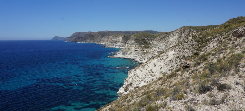
Cabo de Gata-Níjar - officially the Parque Natural Cabo de Gata-Níjar - is a protected stretch of volcanic coast in south-east Almería, in Andalucia. Cliffs, dunes and coves run down to the Mediterranean with very little built on them: about 6,000 people share 30 small settlements across the whole park.
The park is dry and windswept. NASA’s Earth Observatory describes Almería Province, which contains it, as the driest area of Europe (Nasa.gov), and the Junta de Andalucía (Juntadeandalucia.es) says the same of the park itself.
But there's far more here than sand and beaches. Flamingos feed in the salt pans, gold-mine ruins overlook Rodalquilar, famous movie locations abound, and from dusty ravines to dramatic clifftops, the area is home to some of southern Spain’s most inviting hiking trails.
“Volcanoes, cowboys and pirates.” - Ángel Álvarez (Documentation - S-Cape Travel) who has cycled the coast.
Cabo de Gata at a Glance
| Status | Parque Natural, declared by decree of 23 December 1987 (published January 1988) - the first maritime-terrestrial protected space in Andalucia (Juntadeandalucia.es) |
| Marine Reserve | 1995 |
| Ramsar wetland | Salinas de Cabo de Gata, designated 5 December 1989 |
| UNESCO Biosphere Reserve | 1997 - Unesco.org |
| European Geopark | 2001 (now a UNESCO Global Geopark) |
| Specially Protected Area of Mediterranean Importance | 2001 |
| Area | About 49,500 ha: c.37,500 ha of land, c.12,000 ha of sea |
| Municipalities | Almería, Níjar and Carboneras; Níjar holds about 70% of the park |
| Rainfall | 183 mm a year at the Cabo de Gata station; 271 mm at Níjar |
| Wind | On about 84% of days, mainly levante (east) and poniente (west) |
How the Park Fits Together
Cabo de Gata-Níjar is easiest to understand as five zones, from west to east.
- The cape and the salt pans. Cabo de Gata village and San Miguel sit in the west, beside the Salinas de Cabo de Gata. The lighthouse and the Arrecife de las Sirenas mark the cape's southern tip.
- San José and the western beaches. San José is the main base for Los Genoveses, Mónsul, Barronal and Media Luna. Pozo de los Frailes lies about 2 km inland.
- Los Escullos to Las Negras. Los Escullos and Isleta del Moro are coastal hamlets. Rodalquilar, a former gold-mining village, sits inland between San José and Las Negras, in a volcanic caldera.
- Cala San Pedro to Agua Amarga. This is footpath country, where the coves are reached on foot, by boat or by dirt track. Agua Amarga is the northern end of the main coastal walk.
- The north. Carboneras municipality holds Mesa Roldán and Playa de los Muertos. Carboneras town itself lies outside the park.
Why the Coast Looks Like This
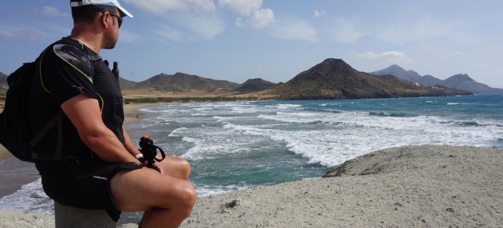
Volcanic activity here began about 15 million years ago and ended about 7.5 million years ago, according to the Junta's Geopark pages. Most of it happened under the sea.
The best-preserved volcanic features date from 9 to 7.5 million years ago. They include domes, calderas and lava flows.
Fossil coral reefs grew on top of several volcanic highs. The flat top of Mesa Roldán is one: a reef about 6 million years old.
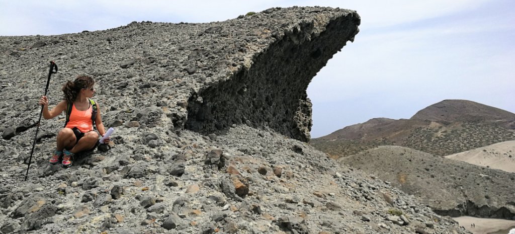
The jagged rocks off the cape, the Arrecife de las Sirenas, are the remains of an old volcanic chimney. Rodalquilar sits in a volcanic caldera, and geologists link its gold to hot fluids from the same volcanic system.
Villages & Bases
San José - The Beach Base
San José is a fishing village and beach town at the foot of Cerro de los Frailes, the park's tallest peak at 493 m. It is the main base for the western beaches.
Doña Pakyta's estate, the largest in the park, lay around it. Her story is told in "Why the coast stayed wild" below.
Need to know: In summer, shuttle buses link San José with Los Genoveses and Mónsul.
Insider tip: Victoria Inguanzo (Product developer, S-Cape Travel) who's walked the coast, recommends San José as the base for walkers: "It has more going on, a good beach and more services, without being too big."
Agua Amarga - A Bay Named Bitter Water
Agua Amarga - "bitter water" in Spanish - is a former fishing village on the park's northern coast. It's the starting point for Cala Enmedio, Cala del Plomo and kayak trips along the cliffs.
Mesa Roldán rises just to the north. The old ore-loading pier is a reminder that the village was once a mining port.
Ángel Álvarez calls Agua Amarga: "the prettiest and quietest village in the park".
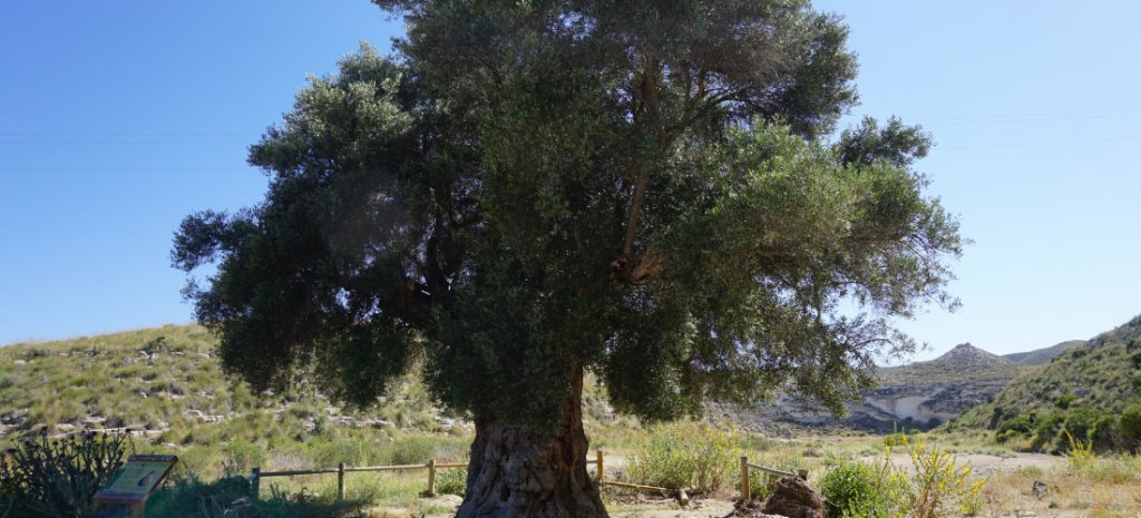
Insider tip: The Olivo Milenario de Agua Amarga grows in the Rambla de los Viruegas, near the village. Specialists estimate it at 1,500 to 2,000 years old, judging by its size (Andalucia.org).
Las Negras - The Village Under the Black Hill
Las Negras takes its name from Cerro Negro, a mass of dark volcanic rock beside the village. About 350 people live there.
It's the usual starting point for the walk to Cala San Pedro - about 4 km, roughly an hour on foot.
Rodalquilar - Gold Town in a Volcanic Caldera
Rodalquilar grew around a gold mine. Gold was found here in the mid-19th century, and the mines closed in 1966. The population fell from about 1,400 at its peak to about 170 today.
Today it’s the park's geology-and-nature hub. It has the Casa de los Volcanes museum (Museorodalquilar.com), the El Albardinal botanical garden and a signed trail through the old mining complex.
Need to know: El Albardinal is free to enter and, according to Andalucía's tourist board, opens Tuesday to Sunday mornings. Check current hours before you go.
Isleta del Moro - A Fishing Hamlet off the Coast Road
Isleta del Moro is a small fishing hamlet, a 500m detour from the coast road between San José and Las Negras. Punta de la Isleta is one of the area’s best snorkelling spots.
Los Escullos - The Fort Above the Cove
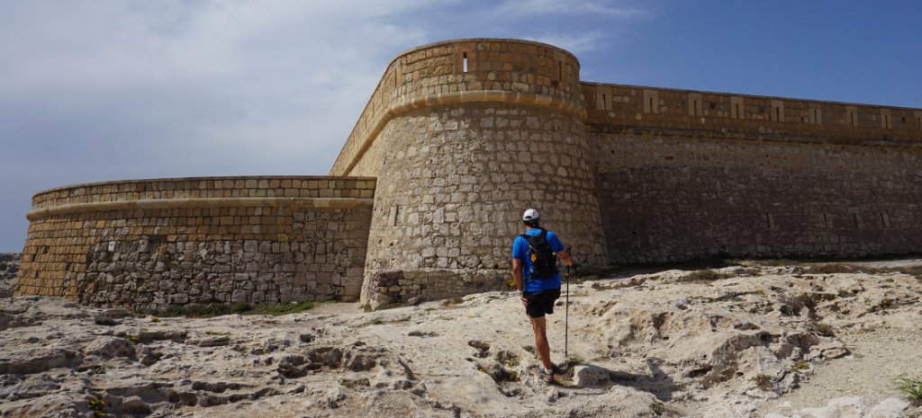
Los Escullos has the Castillo de San Felipe, an 18th-century fort (Castles.nl). The cove below is another named snorkelling spot.
An official trail links Los Escullos with Pozo de los Frailes, passing volcanic domes formed about eight million years ago.
Cabo de Gata & San Miguel - The Western Gateway
Cabo de Gata is the park's main population centre, home to about a quarter of its residents, according to a Geopark research paper. The Salinas de Cabo de Gata lie just behind the beach.
The Las Amoladeras visitor centre, on the road in from Almería, has exhibitions and information on the park (Spain.info).
Pozo de los Frailes - The Well of the Friars
Pozo de los Frailes is a small hamlet about 2 km inland from San José. It's named after a well dug by Almería's Dominican friars.
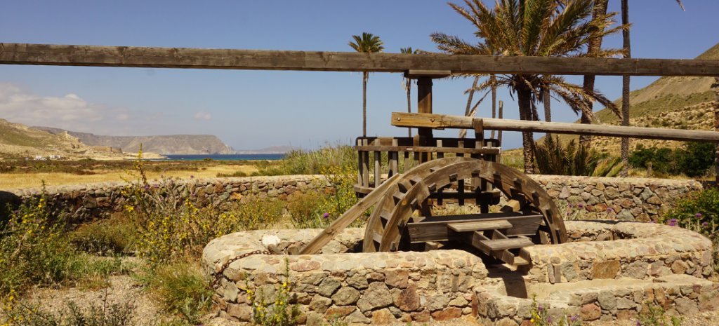
The restored noria stands beside a Junta information point (Andalucia.org). It’s an animal-powered waterwheel of Arab origin, and it was in use until 1983.
Insider tip: The Campo de Níjar once had more than 200 norias of this type. This one has become an emblem of the park.
Níjar - Rugs & Pottery Inland
Níjar, the municipal capital, lies inland. It's known for jarapas - colourful woven rugs - and for ceramics, both of which the Junta lists as part of the area's traditional economy.
It makes a good alternative on a day when the wind rules out the beach.
Beaches of Cabo de Gata
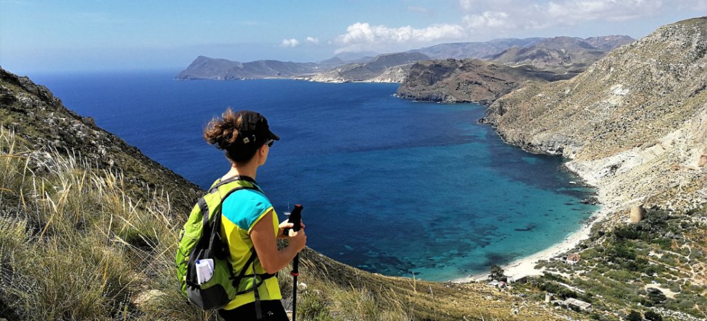
Cabo de Gata-Níjar has dozens of beaches, from long dune bays to coves that need a walk. Access matters more here than the sand.
The wind blows on about 84% of days, mostly from the east (levante) or the west (poniente), according to the Junta's management plan. Check the forecast and choose your cove accordingly.
| Beach | How you reach it | Summer car restrictions | Notes |
| Mónsul | Track from San José, a little over 4 km; shuttle bus in summer | Yes | Dunes and volcanic rock |
| Los Genoveses | About 2 km from San José; same track | Yes | Long bay, dunes, viewpoint |
| Barronal and Media Luna | Same restricted stretch | Yes | Smaller coves |
| Los Escullos | Village beach | No | Snorkelling, fort |
| El Playazo | Rodalquilar's coast, 4 km east | No | Mining history |
| Cala San Pedro | On foot from Las Negras (about 4 km) or by boat taxi; no road | - | Spring, fort, informal settlement |
| Cala del Plomo | Unpaved track, about 7 km, from the Las Negras-Fernán Pérez road | - | No services |
| Cala Enmedio | About 20 minutes on foot from Plomo, 30-40 minutes from Agua Amarga, or by kayak | - | No services, no road |
| Playa de los Muertos | Steep path from the Carboneras side | - | Strong currents |
Playa de Mónsul - Volcanic Sand & Film-Set Dunes
Mónsul lies in Níjar municipality, a little over 4 km from San José. Dunes back a volcanic beach.
It's the location of the scene in Indiana Jones and the Last Crusade where seagulls bring down a German plane (Movie-locations.com). Doña Pakyta allowed the public to use this beach when she owned the land behind it.
Need to know: Private cars are restricted here in summer.
Los Genoveses - The Bay of the Genoese
Los Genoveses is a long bay with dunes, about 2 km from San José. A Junta trail leaflet links its name to a Genoese landing in 1147.
The Morrón de los Genoveses, a volcanic promontory 74 m high, gives a panoramic view over the bay.
Barronal & Media Luna - Small Coves in the Restricted Stretch
Barronal and Media Luna lie in the same stretch as Mónsul and Los Genoveses. Summer car restrictions apply to them too.
Los Escullos - Cove Under the Fort
Los Escullos is a village beach below the Castillo de San Felipe that's one of the best snorkelling spots on the coast.
El Playazo - The Beach Below the Gold Town
El Playazo es la playa de Rodalquilar, se encuentra a unos 4 km hacia el este y cuenta con un aparcamiento sin restricciones. In the mining years, ore was carried down to the beach and loaded onto ships moored in the bay.
At El Playazo stands the Batería de San Ramón, built in 1764 under Charles III to guard the coast against Barbary pirates (Iaph.es). It's now in private hands
Cala San Pedro - Spring, Fort & Informal Settlement
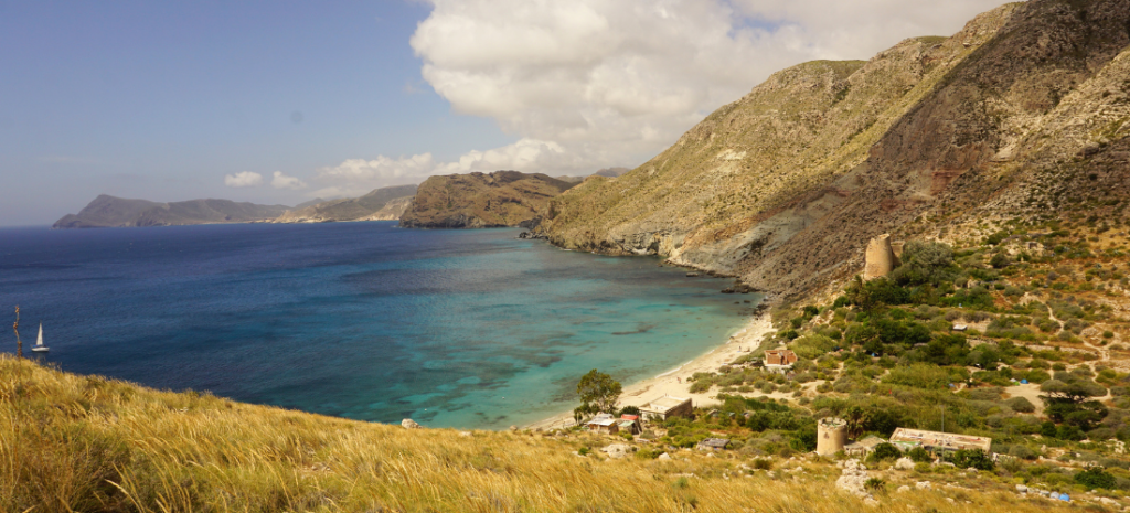
Cala San Pedro has no road. It has a freshwater spring - one of the few on this coast - and the ruins of a coastal fort built against Barbary pirates.
Ángel Álvarez rates it the most beautiful cove in the park. He reports: "the fresh water lets carob, fig, prickly pear and orange trees grow around it".
An informal community, often described as the last true 'hippy community' of its kind in Spain, lives in the cove.
Need to know: Walk about 4 km from Las Negras, roughly an hour, or take a boat taxi in summer. Camping is prohibited in the park, and it's a naturist beach.
Cala del Plomo & Cala Enmedio - Two Coves, One Path
Cala del Plomo is the easier of the pair. A dirt track of about 7 km reaches it from the road between Las Negras and Fernán Pérez.
Cala Enmedio is a short walk beyond it, about 2 km. There's no road to the cove, and neither beach has services. You can also paddle in from Agua Amarga.
Playa de los Muertos - The Beach Named for Shipwrecks
Playa de los Muertos lies behind the Punta de los Muertos, below Mesa Roldán. The name is held to come from shipwreck victims washed ashore by the currents.
Access is not easy and is not advised for small children. Check conditions before you swim.
Need to know: summer vehicle access to Mónsul and Los Genoveses
Each year the Junta de Andalucía publishes a resolution restricting private motor vehicles on the road to the beaches between Genoveses and Cala Carbón. That includes Mónsul, Barronal and Media Luna.
The dates change from year to year: 20 June to 20 September in 2015, 18 June to 18 September in 2016, and 21 June to 28 September in 2025, according to a beach directory. In summer a paid shuttle bus runs from San José. Walkers and cyclists enter free. Check the current year's dates, fares and time bands with the park or Níjar council.
Walks in Cabo de Gata
Cabo de Gata-Níjar has a network of official, signed day walks as well as long coastal lines.
| Walk | Length | Time | Difficulty |
| Los Genoveses (Cerro del Ave María to the Morrón) | 2.3 km one way | 1 h 30 each way | Low |
| Mesa Roldán | 1.9 km one way | 1 hour each way | Low |
| Los Escullos - Pozo de los Frailes | 4.7 km one way | 1 h 50 | Low |
| Cerro del Cinto short variant (Rodalquilar) | 4.4 km circular | 1 h 30 | Low |
| Cortijo del Fraile - Montano - Hornillo | 7.7 km circular | 3 hours | Low |
| San Pedro - El Plomo - Agua Amarga | 11.1 km one way | 4 h 30 | Medium-high |
The Coast Path - From the Cape to Agua Amarga
A coastal walk links the Cabo de Gata lighthouse with Agua Amarga. The GR-92 Mediterranean path passes through the park and coincides with the coastal path in places. Local trails carry their own markers, and there are blue-and-white paint marks on several coastal paths. Not every stretch is continuously marked, so download a track.
Victoria Inguanzo rates Agua Amarga to Rodalquilar as: "the best stretch for walkers, and the circular from San José as the best loop. Both pass many beaches. Routes further inland climb more."
Need to know: There's little shade and few drinking-water points on many coastal trails. Outside spring, summer and the first half of autumn, fewer services are available in the villages.
Insider tip: Many routes cross ramblas - dry riverbeds where the ground is soft sand. Walking them is like walking along a beach, so allow extra time.
Things to See & Do
Cabo de Gata Lighthouse - Where the Cape Meets the Reef
The Cabo de Gata lighthouse stands at the cape's southern tip, beside the Mirador de las Sirenas, where the coast road ends. It dates from 1863 and was built on the courtyard of the 18th-century Castillo de San Francisco de Paula. Only the base wall survives.
The rocks offshore, the Arrecife de las Sirenas, are the remains of an old volcanic chimney. The name probably comes from the monk seals that fishermen called sirenas, which lived on this coast until the mid-20th century (Surinenglish.com).
Insider tip: The name Cabo de Gata may come from the "Promontorio de las Ágatas" - agates found nearby - not from cats. It appears as 'Cabo de Gata' in the 14th century.
Salinas de Cabo de Gata - Salt, Flamingos & Birdwatching
The Salinas de Cabo de Gata are a working salt pan and an internationally recognised wetland. The Junta counts more than 80 bird species here, including flamingos. Observation hides stand along the edge of the pans. Keep to the hides and paths so the birds are not disturbed.
Rodalquilar's Gold Mines - Ruins, Museums & Botanical Gardens
The ruins of the Denver processing plant dominate the village from a nearby hill. State-led mining ran from 1943 until the closure in 1966.
The Casa de los Volcanes, housed in the former foundry building, was the first geotourism centre in Andalucia. Its Rodalquilar hall covers the mining history.
El Albardinal, the botanical garden, shows the plants of Andalucia's arid south-east. Entry is free.
Need to know: Walk around the outside of the plant ruins and follow the signed trail - the buildings and old workings are in a serious state of disrepair.
Cortijo del Fraile - The Farmhouse Behind Blood Wedding
The Cortijo del Fraile is an abandoned 18th-century farmhouse on a windswept plain between Rodalquilar and Los Albaricoques. Dominican friars built it, which explains the name. It's been a protected cultural site since 2010.
Federico García Lorca's play Bodas de sangre (Blood Wedding) draws on a real crime linked to this farmhouse (Wikipedia.org). The bride in the 1928 Crime of Níjar lived here, and the wedding party gathered at the cortijo before the killing, which took place nearby. The full story is in "The Crime of Níjar" below.
It's a ruin, and a fence keeps visitors out. The Diputación de Almería bought the site and in July 2026 published a master plan to turn it into an arts and territory centre. Restoration has not been completed.
Need to know: The cortijo lies roughly halfway between Rodalquilar and Los Albaricoques, at the end of a straight branch of about 1.5 km running north from the road. There is parking for about 20 cars beside it.
Los Albaricoques - Spaghetti-Western Country
Los Albaricoques is a small village inside the park. It stood in for "Agua Caliente" in Sergio Leone's For a Few Dollars More (Spaghetti-western.net), and the village has a street named after Clint Eastwood.
The Cortijo del Fraile also appears in The Good, the Bad and the Ugly, as the mission the two men reach by cart.
Mesa Roldán - Tower, Lighthouse & Fossil Reef
Mesa Roldán is a flat-topped volcanic dome in Carboneras municipality, north of Agua Amarga. Its flat top is a fossil coral reef about 6 million years old.
A horseshoe-shaped coastal tower, built in 1764-66 under Charles III on an earlier Moorish tower, stands on the summit. Next to it is a lighthouse inaugurated on 31 December 1863. The tower was a filming location for Game of Thrones in 2015 (Andalucia.com).
Need to know: The exterior of the tower can be visited freely. The tower itself is abandoned.
Snorkelling & Kayaking - The Marine Reserve at Sea Level
Seagrass meadows of Posidonia oceanica cover much of the seabed. A couple of the main snorkelling spots include Los Escullos, Punta de la Isleta, Cueva del Francés, Cala Enmedio, Cala del Toro and Los Muertos.
Guided kayak trips run from La Fabriquilla to the Arrecife de las Sirenas, and a "pirates" route leaves from Cala del Cuervo. Operators switch routes when the wind or sea state demands it.
Need to know: Anchoring is banned in the marine reserve zones, and a Junta leaflet regulates kayak and diving activity.
The Crime of Níjar
On 22 July 1928, near Níjar, a young woman named Francisca Cañadas Morales eloped on horseback on the night of her arranged wedding. Her cousin and lover was shot dead, and Francisca survived. The Cortijo del Fraile was her home, not the place of the killing.
Federico García Lorca read about the case in the press. He wrote Bodas de sangre (Blood Wedding) in the late summer of 1932, and it premiered on 8 March 1933 at the Teatro Beatriz in Madrid.
Carmen de Burgos, a writer born in Rodalquilar, published her own version, Puñal de claveles, in 1931. A scholarly paper finds no evidence that Lorca knew it. One account reads the affair as a dispute over inheritance as much as over honour.
Cabo de Gata On Screen
|
Mónsul: the seagull-and-plane scene in Indiana Jones and the Last Crusade, shot in 1988. Rodalquilar's mines and a tunnel towards Agua Amarga doubled for another chase in the same film. Algarrobico and the dunes: the beach at Algarrobico stood in for Aqaba in Lawrence of Arabia, and the train explosion was shot in the Cabo de Gata dunes. Los Albaricoques and the Cortijo del Fraile: Sergio Leone's westerns. Mesa Roldán: Game of Thrones, season six. Just outside the park: the Tabernas Desert and the Mini Hollywood attraction carry the western theme further. |
Pirates & Watchtowers
Barbary pirates raided this coast, and the Spanish crown answered with towers, batteries and forts. Several survive inside the park.
- Castillo de San Felipe, Los Escullos. This bastioned coastal fort was built under Charles III in the 18th century and restored in 1991. The exterior can be visited freely.
- Batería de San Ramón, El Playazo. A four-gun battery built in 1764 under Charles III. It's now in private hands.
- Mesa Roldán. The horseshoe-shaped tower of 1764–66 stands on an earlier Arab tower, above the coast north of Agua Amarga.
- Cala San Pedro and the cape. The fort at Cala San Pedro is a ruin built against pirates. At the lighthouse, only the base wall of the 18th-century Castillo de San Francisco de Paula survives.
Why the Coast Stayed Wild
Doña Pakyta is the figure most often credited with keeping Cabo de Gata undeveloped. Her official name was Francisca Díaz Torres (1911-2014). She owned 3,300 hectares around San José, including about 17 km of coast, and she allowed the public to use her beaches.
The Junta de Andalucía made her 'Hija Predilecta de Andalucía' in 2010. Her refusal to sell is a separate story from the park's Biosphere Reserve designation in 1997.
Almería & Getting There
Almería is the practical gateway. San José is about 35 km from Almería Airport, and Agua Amarga about 55 km.
Málaga, Granada, Murcia and Alicante airports are further away and need onward coach connections. Buses run between Almería and San José, with fewer services at weekends. Check timetables before you travel.
Insider tip: The Tabernas Desert lies about 30 km from the park and has been called mainland Europe's only desert. It can be visited as a day trip.
When to Go & Practical Information
Spring and autumn are the most comfortable seasons for walking. Summer is hot and busy, and beach access is restricted.
The mean annual temperature is about 18 °C. Rainfall is low, with 183 mm at the Cabo de Gata station and 271 mm at Níjar.
Carry water on all coastal walks. Shade is scarce, and the wind blows on most days.
Many hotels and cafés close outside summer, and only a few shops stay open. Check before you set out.
Overnight camping is prohibited in the Natural Park. Do not take rocks, fossils, shells or plants.
Frequently Asked Questions
Is Cabo de Gata a national park? No. It is a Natural Park - the Parque Natural Cabo de Gata-Níjar - declared in 1987 and published in January 1988. It is also a UNESCO Biosphere Reserve and Geopark.
Is Cabo de Gata a desert? Not strictly. Official sources describe it as semi-arid, and the Junta calls it the driest area in Europe. The nearby Tabernas Desert is the one usually called Europe's only desert.
What is Cabo de Gata famous for? Its volcanic coast, its beaches and coves, its salt pans with flamingos, its gold-mining history and its film locations.
What is the best time to visit Cabo de Gata? Spring and autumn suit most visitors. Summer is hot and busy, and cars are restricted on the road to Mónsul and Los Genoveses.
What are the best beaches in Cabo de Gata? Mónsul and Los Genoveses are the best known. Cala Enmedio, Cala del Plomo and Cala San Pedro need a walk. Playa de los Muertos has a steep path.
How do you get to Cabo de Gata from Almería airport? By road. San José is about 35 km from the airport and Agua Amarga about 55 km. Buses run between Almería and San José.
Do you need a car in Cabo de Gata? A car helps for Rodalquilar, Los Albaricoques and the dirt track to Cala del Plomo. San José and Agua Amarga work as bases without one, and a shuttle bus serves Mónsul and Los Genoveses in summer.
Can you swim at Playa de los Muertos? Yes, but check conditions first. Access is steep, and the currents have a history of washing shipwreck victims ashore.
Can you visit the Cortijo del Fraile? You can see it from outside. It is fenced off and entry is banned, but a restoration plan was published in 2026.
How many days do you need in Cabo de Gata? Three days cover the main sights. Five give time to walk part of the coast.
Like the sound of exploring one of southern Spain's most beautiful coastal corners? Check out our self-guided walking holidays in Cabo de Gata.
Marketing, Web & Design
After studying in my hometown of Barcelona and spending several years abroad, I relocated in 2018 to Cabrales, a beautiful rural area in Northern Spain. I invite you to check out some photos of Cabrales to see the incredible views we enjoy from our office!
After a few years in reservations, I now manage the website and marketing for S-Cape Travel, where I handle design tasks, blog writing, and attend specialized travel fairs.
Most popular








Contact
-
Edificio Sovega bajo, Crta General s/n
33554 Arenas de Cabrales
Asturias , Spaininfo@s-capetravel.eu
+34 (0) 985 846 455
UK call free 0800 707 44 35 -





Opening hours: Mon-Fri 9:00am – 6:00pm (CET)
Opening hours: Mon-Fri 9:00am – 6:00pm (CET)