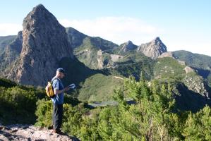
Hiking routes in the Canary Islands and GPX track downloads
The Canary Islands are a paradise for hiking enthusiasts. Whether you’re looking for a gentle coastal walk or a challenging ascent to a volcanic peak, you’ll find well-marked routes on every island.
To make planning your trip easier, the Canary Islands Government provides official route tracks that you can download free of charge and carry on your GPS device or mobile phone. This way, you can follow the trails safely and with up-to-date information.
In this article, you’ll find a selection of routes on each island – from the easiest to the most demanding – along with a direct link to the official page where you can download the GPX track.
La Gomera
Vallehermoso – Playa de Vallehermoso
3.7 km. 1 m ascent, 156 m descent. Download GPX track
Reventón Oscuro – El Cedro – Reventón Oscuro
5.8 km. 3.5 hrs. 300 m ascent/descent.
Agulo Circular via Juego de Bolas
7.7 km. 3 hrs. 610 m ascent/descent.
San Sebastián de La Gomera – Hermigua
26.7 km. 8 hrs. 1,025 m ascent / 1,010 m descent. Download maps & GPX track
Hermigua – Playa de Vallehermoso
15.3 km. 6.5 hrs. 920 m ascent/descent. Download maps & GPX track
San Sebastián de La Gomera – Degollada de Peraza
9.8 km. 1,000 m ascent, 70 m descent. Download maps & GPX track
Chipude – Vallehermoso
14.3 km. 5 hrs. 462 m ascent, 1,351 m descent. Download maps & GPX track
For official La Gomera routes: www.caminosnaturales.es/sector-canario
Prefer us to help organise your trip to La Gomera? Take a look at this itinerary including 6 of the island’s top routes. While you walk, we’ll transfer your luggage to the next hotel.
Tenerife
Las Portelas – Masca (PR-TF 59)
3.65 km. 1.75 hrs. 392 m ascent, 426 m descent. Download GPX track
Anaga – Chasna (GR 131.1)
3.6 km. 1 hr. 14 m ascent, 89 m descent. Download GPX track
El Palmar Loop walk (via Las Lagunetas)
7.3 km. 2.5 hrs. 462 m ascent/descent. Download GPX track
PNT 04 Siete Cañadas Trail
17 km. 4.5 hrs. 412 m ascent, 318 m descent. Download GPX track
Vilaflor – Paisaje Lunar – Vilaflor (PR-TF 72)
13 km. 5 hrs. 852 m ascent/descent. Download GPX track
Garachico – Chinyero (PR-TF 43)
18 km. 7 hrs. 1,810 m ascent, 422 m descent. Download GPX track
El Contador – Parador Nacional (PR-TF 86)
15.8 km. 7 hrs. 1,588 m ascent, 688 m descent.
For more Tenerife routes you can also check www.tenerifeon.es/itinerarios
Not sure how to plan your walks in Tenerife? At S-Cape, we’ve designed two trips: one for those travelling by car, and another including quality accommodation and all necessary transfers, luggage included – so you can enjoy the trails without the weight.
La Palma
Cubo de La Galga
4 km. 120 mins. Download PDF
Ruta de los Molinos, from Sta Cruz de la Palma (PR-LP 02.2)
7 km. 2 hrs. 410 m ascent/descent. Download GPX track
Cubo de La Galga (extended route)
12.4 km. 7.5 hrs return. 750 m ascent/descent. GPX track and map
Pico de la Nieve – Santa Cruz de la Palma
17 km. 5.5 hrs. 70 m ascent, 2,300 m descent. GPX track and map
Roque Los Muchachos – San Juan de Puntallana
15.8 km. 4.3 hrs. 1,560 m descent. GPX track and map
Llanos de Aridane – Caldera de Taburiente (PR-LP 13)
27 km. 8 hrs. 1,400 m ascent/descent. GPX track and map
Visitor Centre – Pico Bejenado
16 km. 6.5 hrs return. 1,050 m ascent/descent. GPX track and map
For official La Palma routes: www.senderosdelapalma.es/footpaths
Gran Canaria
Find the routes below and more at www.grancanariasenderos.com
Circular Tamadaba
10 km. 2.5 hrs. 380 m ascent.
Circular Artenara – Cuevas Caballero
9 km. 3 hrs. 500 m ascent/descent.
Llanos de la Pez & Mirador Pozos Pico de las Nieves
7 km. 2.2 hrs. 600 m ascent/descent.
Juncal Tejeda (Route C35)
12 km. 4 hrs. 600 m ascent/descent.
Lagunetas Route C20
20 km. 6.75 hrs. 1,000 m ascent/descent.
Agaete – Artenara
20 km. 6.5 hrs. 1,200 m ascent.
Teror – Playa de Mogán, Las Palmas
20 km. 6.5 hrs. 550 m descent.
Find all official routes at www.grancanariasenderos.com
At S-Cape, we’ve prepared a 1-week Gran Canaria trip with 6 routes – from the lush ravines of the Agaete Valley to the arid volcanic interior. Stay in charming, traditional Canarian hotels.
El Hierro
GR-131 Section 4: Ermita de la Virgen de los Reyes – Faro de Orchilla
5.5 km. 2.5 hrs. 585 m descent. GPX track and map
El Verodal – El Sabinar
3.2 km (one way). 1 hr. 415 m ascent, 70 m descent. GPX track and map
Isora – Tiñor – Puerto de La Estaca
8.8 km. 3.4 hrs. 80 m ascent, 960 m descent. GPX track and map
Camino de los Pastores – Julán
16.2 km. 6.5 hrs. 415 m ascent, 105 m descent. GPX track and map
GR-131 Section 3: Valverde – Ermita de la Virgen de los Reyes
27.6 km. 10 hrs. 945 m ascent, 860 m descent. GPX track and map
Fuerteventura
Find detailed route info at www.fuerteventuractiva.es
Lanzarote
Find official hiking routes at www.lanzaroteofficial.com/senderos
Marketing, Web & Design
After studying in my hometown of Barcelona and spending several years abroad, I relocated in 2018 to Cabrales, a beautiful rural area in Northern Spain. I invite you to check out some photos of Cabrales to see the incredible views we enjoy from our office!
After a few years in reservations, I now manage the website and marketing for S-Cape Travel, where I handle design tasks, blog writing, and attend specialized travel fairs.


Opening hours: Mon-Fri 9:00am – 6:00pm (CET)
Opening hours: Mon-Fri 9:00am – 6:00pm (CET)